Rosetta Head

On Sunday mornings Suzanne changes her walking route. Instead of walking to and over Rosetta Head, she and Maleko do a loop walk: from Solway Crescent to Kings Beach Rd, along the coastal path or Heritage Trail to Petrel Cove, then back to Solway Crescent.

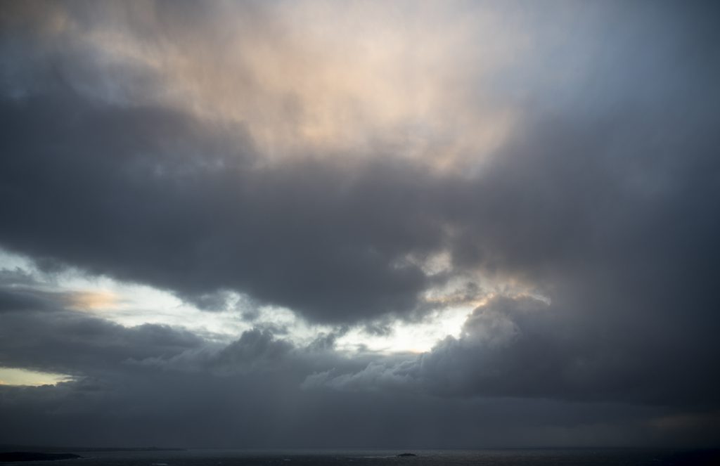
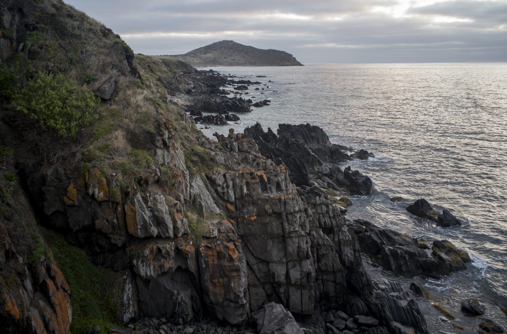
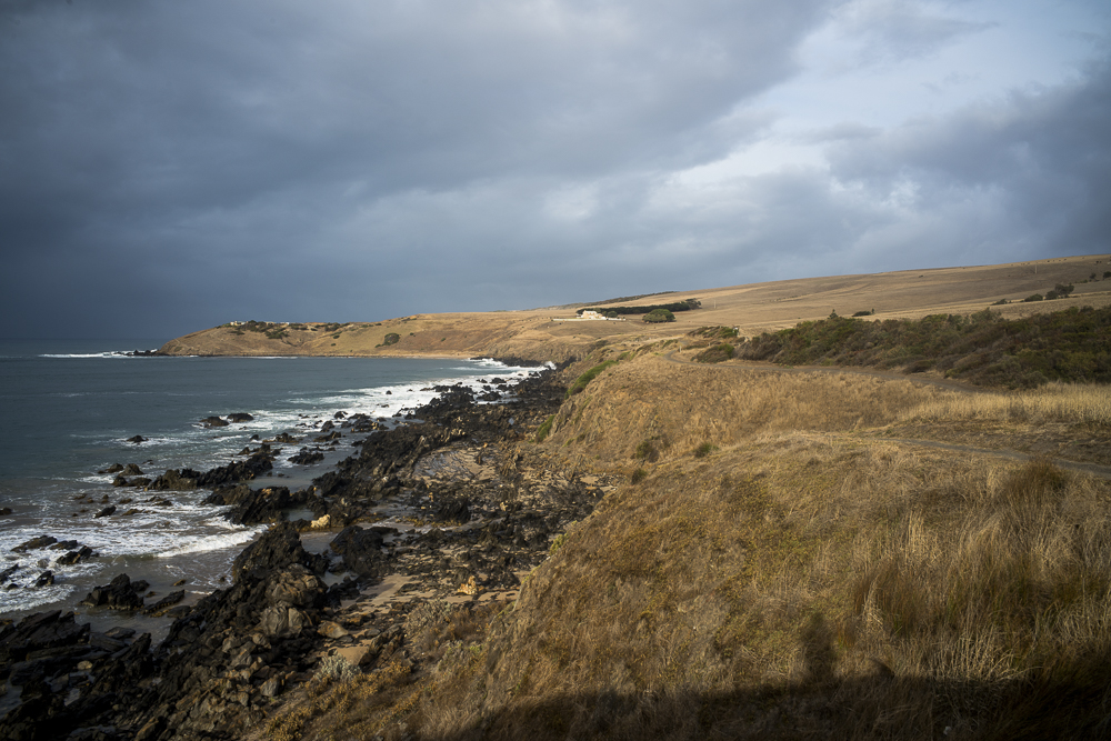
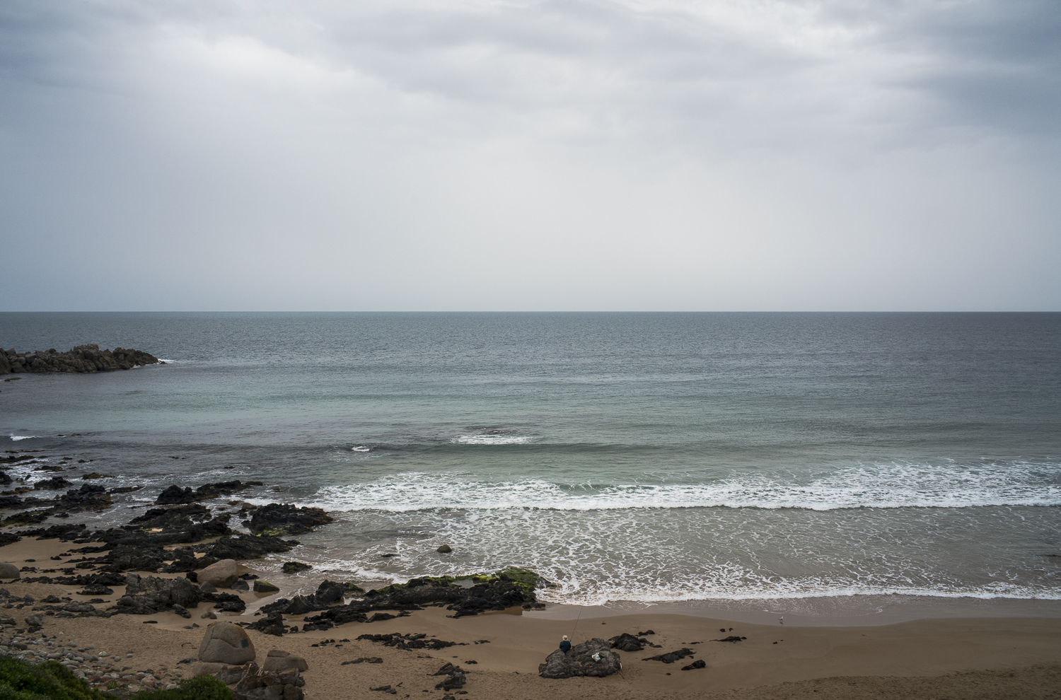
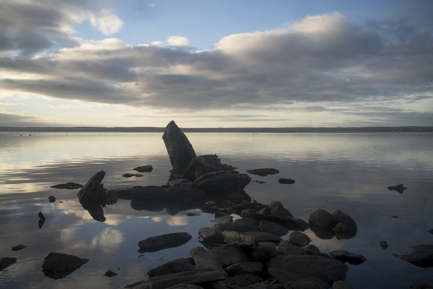
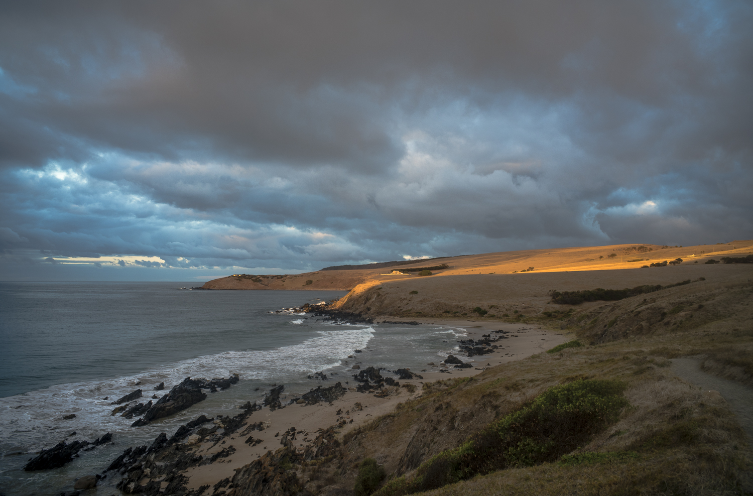
If the weather is cloudy or overcast on Sunday morning I take a break from my early morning walk with Kayla in the local bushland, or along Esplanade Beach, to walk up and over Rosetta Head.

On these occasions I often use the Sunday morning walk to Rosetta Head to make cloud studies and seascapes, though this is scoping is in a very exploratory sense. Rosetta Head provides a good vantage point for this kind of photography, but the actual scene that l do photograph depends on the type of light as well as the clouds.

winter starts: walking and thinking

June 1 dawned with cold, blustery south westerly winds, dark clouds, driving rain and big seas. Winter had arrived on cue.

This cloud formation is what greeted Kayla and myself on the early morning poodlewalk on June 1. We hugged the northern edge of Rosetta Head to escape the 50 km south-westerly wind. I was looking across Encounter Bay to Goolwa and to the Coorong.

winter

The weather was too wild to continue to the top of Rosetta Head and down the southern side, so we turned away from the coast, which is where we normally walk and photograph, jumped in the car and drove inland to seek some protection from the gusty, driving wind. We walked up and down Depledge Rd for about 30-40 minutes before I decided to return to exploring the bush “reserve” that ran adjacent to the western side of Depledge Rd in Waitpinga. We had had walked within this “reserve” a few days before.

cliffs and ocean

On a recent poodlewalk to Kings Head and beyond one overcast morning in February I made a few photos of the cliffs I was walking along. This snap is looking back to Rosetta Head, or The Bluff:

Rosetta Head

The next morning we clambered down the cliffs via the dried up waterfall to the rocky foreshore as I wanted to make a photo of the cliffs and sea with the early morning light on the rocks.

Ho-Hum + the tourist gaze

After my return from the Overland Corner Reserve trip I felt a bit deflated when I was walking along the coastal beaches in both the early morning and the late afternoon. Photographing whilst walking in the littoral zone along the these beaches seemed a bit ho-hum, low key and rather mundane. I even started to toss up taking a camera with me.

Mundane and ho hum because I am back to photographing seaweed again whilst I am walking along the Esplanade town beach with Kayla early in the morning before sunrise. I arrange this walk so that I am making my way through the clusters of seaweed after sunrise whilst consciously trying to avoid the way the tourist’s gaze aestheticizes this seaside resort.

seaweed, Esplanade Beach

There is a sense of dull repetition in that I keep doing the same thing over and over again, without really knowing what I am going to do with all these coastal images. It is becoming a bit routine if not automatic.

Agricultural landscapes

As mentioned in this post on my Encounter Studio blog I have started to explore the back country roads and the agricultural landscape in and around Waitpinga whilst on our afternoon poodlewalks. The Fleurieuscapes project needs to include the rural landscape in order to have some balance to the coastal images in the littoral zone. Most of the space of the Fleurieu Peninsula is an agricultural landscape consisting of dairy farms, grazing land for sheep and cattle, and the rapidly expanding vineyards.

I do struggle with photographing this subject matter, and most of what I see and then scope with a digital camera on our poodlewalks is boring and uninteresting, especially when I look at the digital files on the iMac’s computer screen. I am finding it to be a depressing and disheartening process.

One exception is this picture of pink gum, with a farm shed, silo and water tank along Pitkin Rd in Waitpinga that I came across on an exploratory afternoon poodlewalk with Kayla and Maleko:

Pitkin Rd, Waitpinga

This scoping picture was made in the autumn, when I first started to consciously explore the back country roads in Waitpinga. This picture of a dry, agricultural landscape works much better for me in black and white. The initial colour image looks too pretty and touristy–the photos would be what you would see in a feature in the glossy Fleurieu Living Magazine.

After the rains

As mentioned in an earlier post it is very quiet along the southern coast of the Fleurieu Peninsula these days, even after the rains. Despite the atmospheric conditions it’s only the locals who are out and about in the early morning before sunrise.

When I parked the Forester at the Petrel Cove carpark before dawn this morning (May 20th) it looked as if the ‘after the rains’ scenario was a misreading of the weather. The cloud cover was heavy, the clouds were dark, and there was rain out at sea. So I put a rain coat on, left the tripod and Rolleiflex SL66 in the boot of the Forester and went walking.

Kings Head, Waitpinga

As we walked along the Heritage Trail to Deps Beach and the rocks beyond the beach Kayla and I encountered an echinda making its way along the Trail. I saw a couple of seals and a pod of dolphins hunting in the sea along the edge of the coastal rocks. There was the odd speckled Pacific Gull sitting on the rocks and some seagulls. Apart from that we had the coast to ourselves as we made to the rocks past Deps Beach.

at Petrel-Cove

Many of the coastal morning poodlewalks with Kayla incorporate the  return walk along the coastal  rocks  to the car park  via Petrel-Cove. Incorporating Petrel Cove  is more frequent in the early spring,  due to my  allergy to the rye grass growing along the side of the coastal path.  It irritates my eyes and causes sneezing fits.

Occasionally there is a photographer on the beach or a surfer  but more often  than not,  the  only other person in  Petrel Cove at that time of the morning is  the odd fishing man:

fisherman, Petrel Cove

Often it seem as if the fishing men  standing on the edge of the sea with their lines are meditating in nature,  and are  not overly  concerned if they don’t  catch any fish.  I can understand that as I often just sit on the rocks and watch the action of the waves.  Continue reading “at Petrel-Cove”

revisiting the American River photos

I have  finally started adding some  images to the  skeleton galleries  of this low -fi website–eg., it is the  portrait and the road trip galleries that I have been working on.  The additions are  adding some  flesh to the skeleton, as it were.

In going back through my 2018  digital archives on the hard drive of the  2017 iMac  I  came across the images  that I had made whilst  on  my  brief holiday  at  American River on Kangaroo Island in South Australia.

seascape, American River

The images that caught my eye were the ones I made on an early morning autumn walk along the shoreline of the estuary on my  last day of the  brief  holiday. I had never done this on previous visits,   as I had though that this part of the estuary at American River  was more or less inaccessible. Continue reading “revisiting the American River photos”

winter’s wild-seas

I spent the last few days taking advantage of the sunny mornings before I left  for Alpana Station near   Blinman, to go on  a 13 day   camel trek in the Northern Flinders Ranges in South Australia with Suzanne and some of  her Heysen Trail friends.

seaweed+sand

This fine weather did not last  for long. The weather turned story,  and I ended up  exploring the wild-seas amongst the coastal granite rocks  between Petrel Cove and Kings Beach. Continue reading “winter’s wild-seas”

along the Heritage-Trail

These clouds and early morning light  are   what I saw on early on  Friday  morning   when  Kayla and I were walking along the Heritage-Trail  through a familiar coastal landscape.   It was so very still that morning.

These are the  kind of conditions that  indicate that a dramatic change in the weather  is about  to happen; usually, they mean that the hot weather is coming to an end,  and  a  big  storm will be sweeping into the coast of the  Fleurieu Peninsula  from the south west.

am, Dep’s Beach

It was the morning  of  the 13th April, which is when  the cold front  with its  wild winds and  driving rain,  hit the southern coast of the Fleurieu Peninsula in the late afternoon.

I was taking advantage of the lull before the storm  to walk   to a specific site  amongst the granite rocks around the point from Dep’s  Beach; a site that  I had selected for a large format photo session.   Continue reading “along the Heritage-Trail”