It has been about five months since the last post on poodlewalks. Some explanation for the hiatus is mentioned here on The Littoral Zone. Posting on this website was also on the backburner due to the trip to Japan, which took place shortly after the last post in late September 2023. Roughly editing the photos that I made whilst in Japan pretty much preoccupied me for the rest of that year.
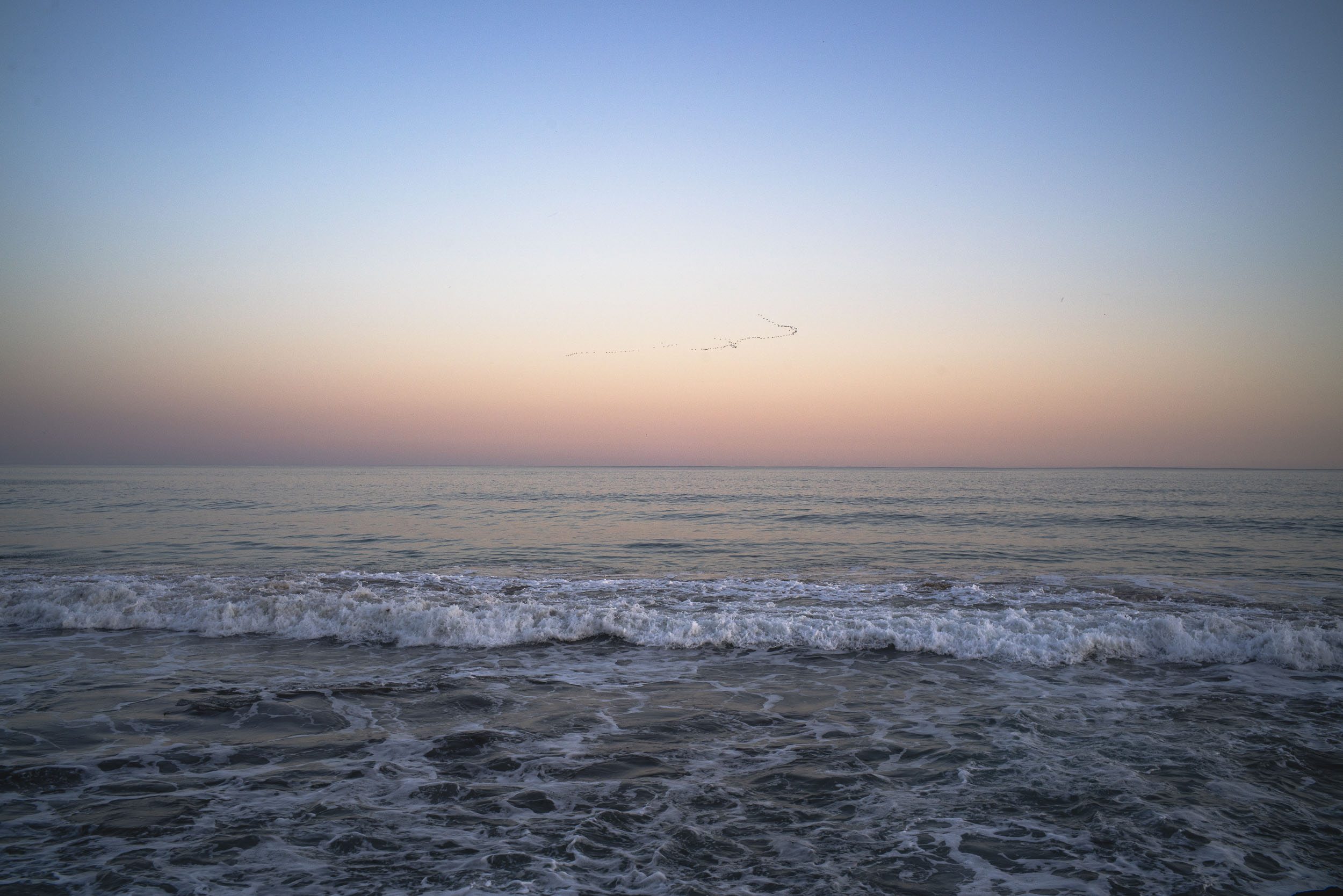
The last photos I made before I left for Japan in mid-October were those in the seascapes series on the early morning walks and in the evening ones in the magic hour.
dusk seascape
The archive indicates that even though I was walking with the poodles and making photos in the Nov-Dec period after I’d returned from Japan, I didn’t re-connected to the next step of posting the images on the poodlewalks website.
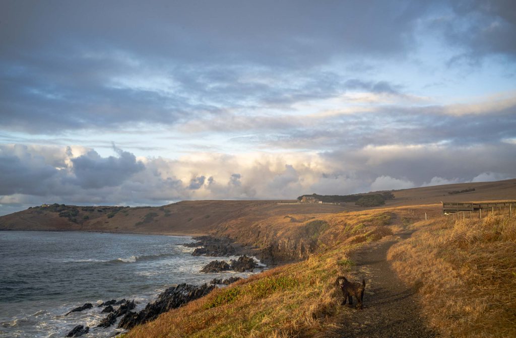
I have started to do a few early morning walks along the coast with Maya. As she is still just 11 weeks old we need to continue to avoid other dogs until she has her second round of injections at 12 weeks. So we start our morning walks before sunrise and are back at the Forester by around 7.30. We have been lucky as it is very quiet and there are few, if any, people walking along the coast around sunrise.
The early autumn mornings have been overcast with the cloud cover with the occasional light showers. It clears during the day and the late afternoons are characterised by blue skies, sunshine and light to medium coastal winds.
Maya, Whale Lookout, Waitpinga
We don’t walk that far from our starting point at the Kings Beach Whale lookout — not even to Dep’s Beach. Dep’s Beach like Petrel Cove, is still layered with dead baby carp from the River Murray, and as this is snack food for Maya we avoid the beaches, we stay on the clifftop path and find areas amongst the coastal vegetation for Maya to play around in.
Given the general decline of the rural sector seaside or coastal towns depend on domestic tourism to survive. In the process of encouraging tourism, seachange retirees and regional growth they are in danger of damaging, if not destroying, the very natural attractions that made them so attractive to people in the first place.
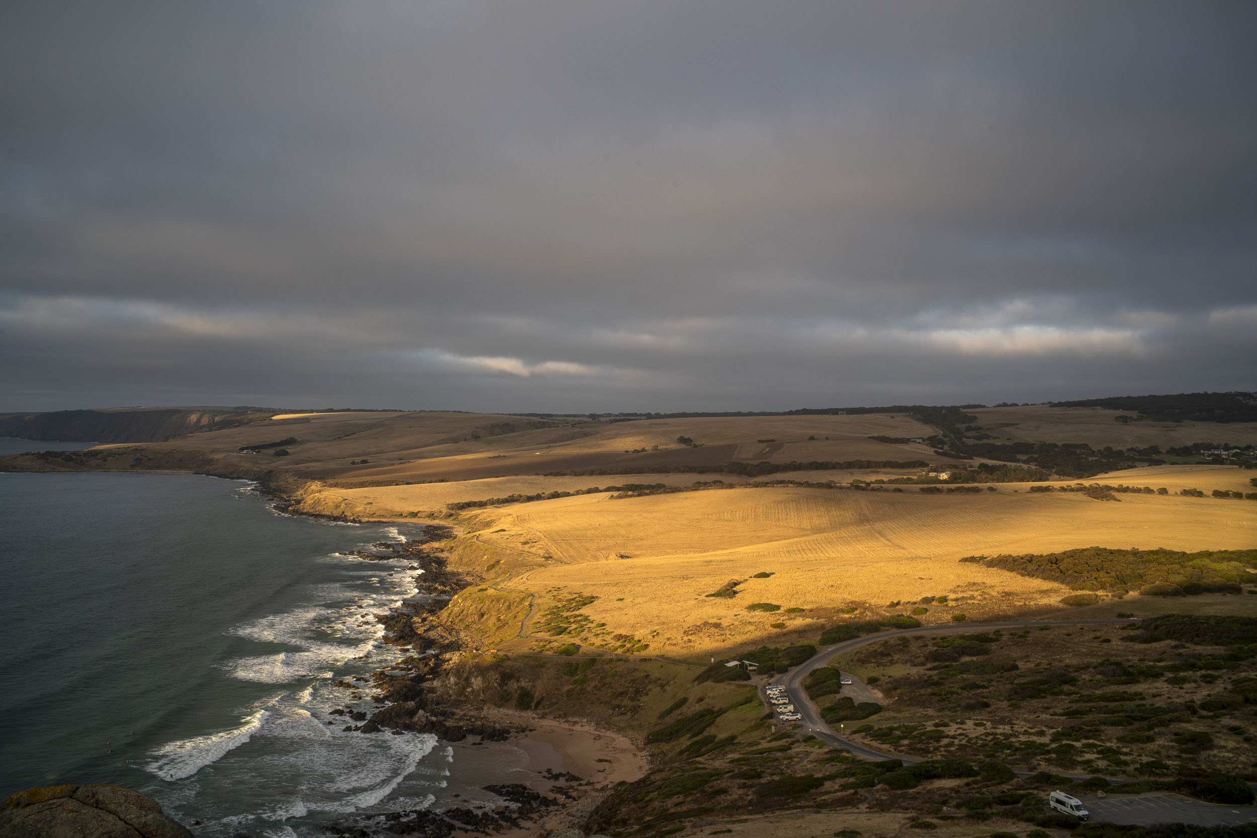
Victor Harbor on the southern Fleurieu Peninsula of South Australia is a classic example . Tourism has replaced the dairy and grazing farms in terms of economic importance. The city council has invested substantial funds to rebrand the town from being a run down and decaying service centre for the the agricultural industry to a tourist town. The rebranding involved giving the town centre a design facelift. The town has become more attractive but its economy is low-wage work such as retail and hairdressing that exist to serve local residents. A high tech hub of innovation and creativity it is not.
Tourist development is already happening. There is a Heritage Trail that runs west from Petrel Cove, which link up with the Heysen Trail at Kings Beach Lookout. Both Trails form part of the Wild South Coast Way on the southern Fleurieu Peninsula. There is also a Bluff (Rosetta Head) Master Plan, which is in process of being put together, based on community feedback that emphasizes walking not more carparks. These are low key eco-tourist developments with a light footprint. You enjoy the coastline by walking it.
Petrel Cove coastline
The Victor Harbor Council has not publicly responded to the community feedback re the Bluff Master Plan, but the plan does not include the privately owned farmland west of the Rosetta Head reserve. Under SA’s new planning system Victor Harbor is part of the Greater Adelaide Planning Regionand it is unclear whether the Victor Harbor Council will assess the proposed development or whether the planning authority is Planning SA and the state government.
The picture above is from January 2022 and it was made from Rosetta Head (Kongkengguwar) on an early summer morning. It looks west across Petrel Cove down along the coastline to Kings Beach and Kings Head. The Waitpinga Cliffs are in the background. It is a fantastic coastline that needs to be cared for as the farmland is sold. Massive and ugly development would destroy it.
The area just west of the Petrel Cove car park and the green belt in the above picture is earmarked for a proposed tourist property development by Tirroki Pty Ltd consisting of 5 self-contained accommodation units (4 single and 1 double unit with carports) and service building/s on the current farmland. It runs east/west from Jagger Road to the Heritage Trail with access from Jagger Rd.
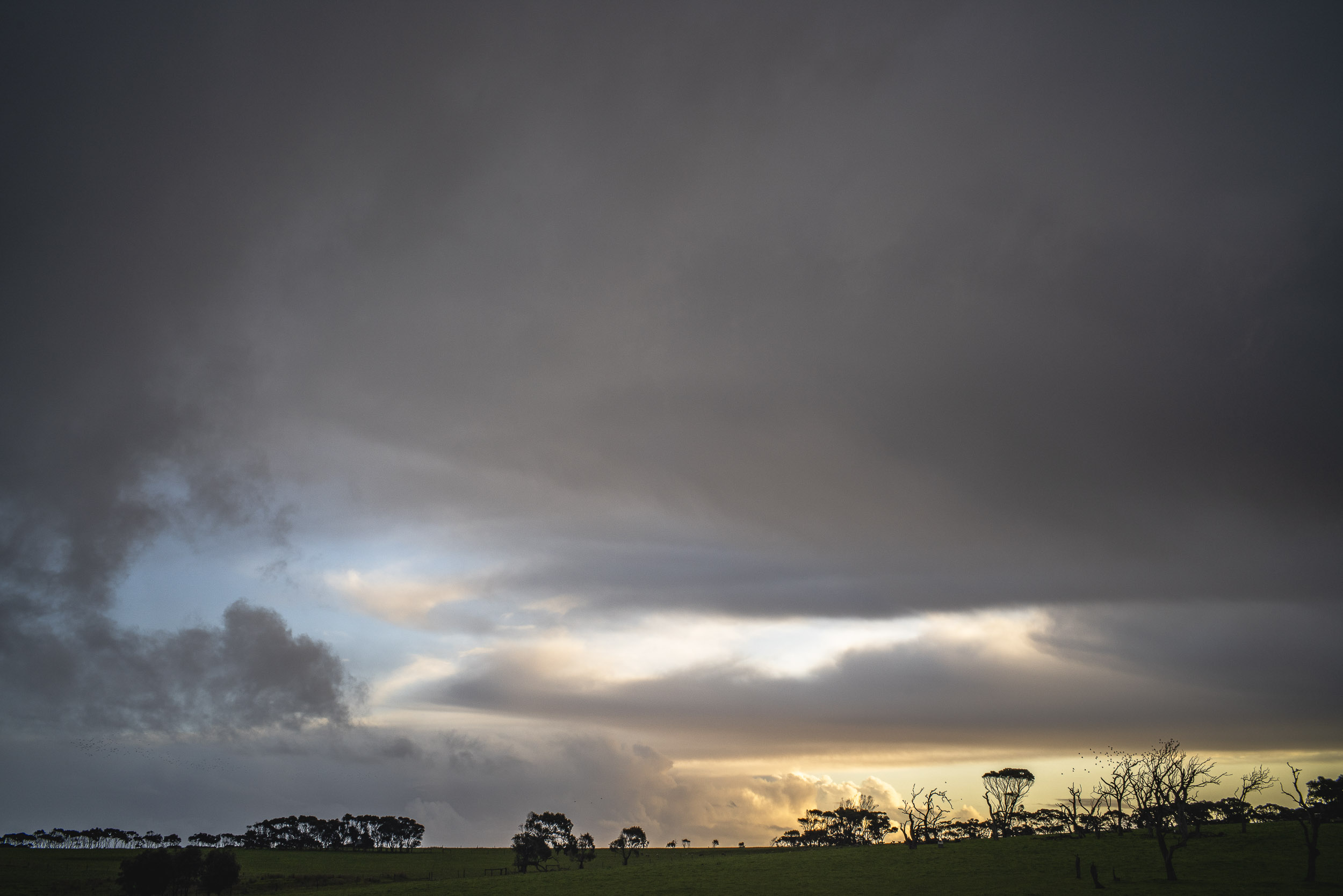
The weather since our return to Encounter Bay from our 12 day trip to the Vulkathunha-Gammon Ranges in South Australia has been continually stormy. There has been strong to gale force north westerly winds and regular rain, with a few fine periods within, and between, the series of cold fronts. The winds have often been chilling with rain falling each day. The earth is saturated.
It has been very atmospheric as we attempt to walk avoiding the wind and the showers. More often than not we are caught in the rain as it is fine one minute then rain the next.
looking west, Dump Rd, Waitpinga
Whilst on the poodlewalks we often have to sit the rain out — either in the car or seeking shelter whilst on the walk. The showers ease and we walk on. Sometimes this happens several times on a single poodlewalk. More often than not we get caught by the rain.
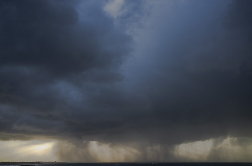
An icy cold snap with lots of rain and bitterly south westerly winds hit the southern Fleurieu Peninsula of South Australia in late May/early June. It has been extremely cold when the sun has gone missing, with the cold snap lasting a fortnight or more. Though there have been the occasional days with sunshine, the rain and cold winds usually return the next morning. Consequently, walking with poodles is walking in the bracing wind and the rain:–rain walks.
The daily poodlewalks in early June included walking Rosetta Head ( Kongkengguwar ) in Victor Harbor so that I could photograph the sky, rain, sea and light. These photographs have usually been seascapes (as distinct from coastal), though I sometimes I have been photographing the clouds themselves.
rain, Encounter Bay
We have been walking Rosetta Head in the early morning before sunrise, as the weather has usually cleared by the late afternoon, with this occasion on the last day of May being a notable exception. The walking and photography in low pre-sunrise light works well with a hand held digital camera.
It is much more difficult with the large format camera and tripod, especially when it is a 5×7 monorail. Much more organization and planning is required, as I need to check out both the cloud cover and the direction of the wind to see if it is worthwhile carrying the camera equipment up Rosetta Head. If it is, then it is a slow walk and climb.
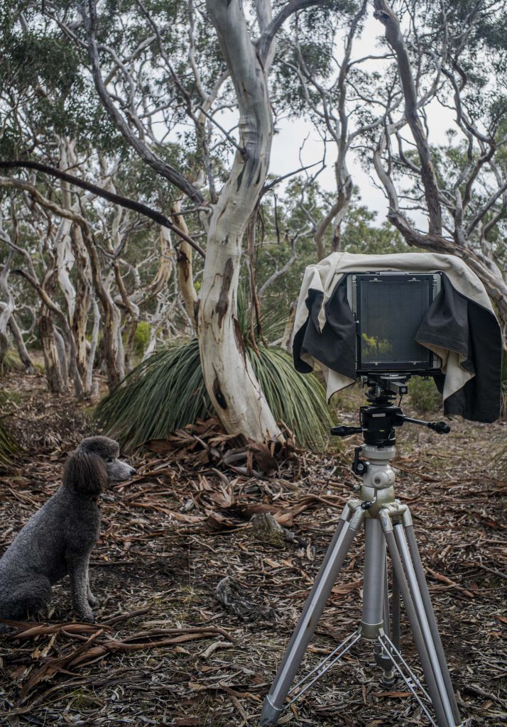
A recent afternoon poodlewalk in the local Waitpinga bushland in the southern Fleurieu Peninsula incorporated an 8×10 photo session. This session was a response to a disappointing one in the Spring Mount Conservation Park the previous day. Then I never even took the 8×10 out of the Forester. I had been hoping for misty conditions when I was driving there, only to encounter light rain when I was walking around.
Maleko + 8×10 Cambo, Waitpinga
It is more accurate to say that on the Waitpinga poodlewalk the photo session was first and the poodlewalk with Maleko came afterwards. I carried the camera equipment to the site, made the photo, returned the equipment to the Forester, then Maleko and I went on a walk through the bushland.
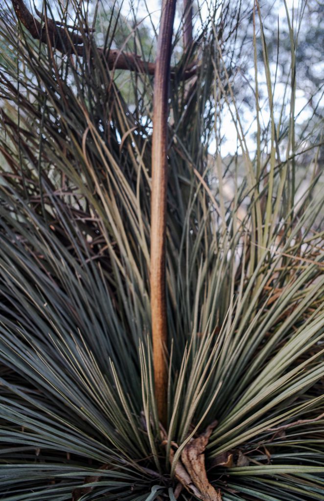
Last week Kayla and I were walking along a dusty, unsealed Depledge Rd in the early morning prior to wandering around in the local patch of bushland in Waitpinga in the southern Fleurieu Peninsula of South Australia.
A light, but cool, sou’ easterly wind was blowing across the field onto our bodies, the orange-brown Monarch butterflies were notable by their absence, and the yellow tailed cockatoos were watching us and sounding the alarm with their wailing calls. I could hear the laughing kookaburras in the distance.
The sun had just risen above the trees on the eastern horizon and its soft rays highlighted this grass tree (Xanthorrhoea) on the dusty roadside just as we were passing by. We stopped and I looked.
dusty Xanthorrhoea
The sun’s rays were quite weak at that moment since they were shining through the distant trees after rising above the horizon. It doesn’t stay like this for long as the rays find a gap in the trees.
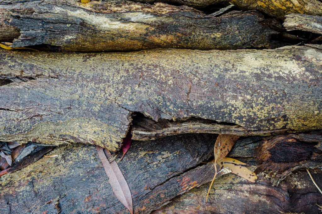
I have spent many an early morning during the late summer of 2022 wandering through the local bushland with Kayla. There are lots of smells for her (eg., foxes, rabbits, kangaroos) and there are some photographic possibilities for me.
wet bark
It had been raining during the previous day, which was very unusual for summer in the Fleurieu Peninsula. This was in early January during a cool summer. Summer is normally hot and dry with no rain for 5 or so months. The rains normally start in late April.
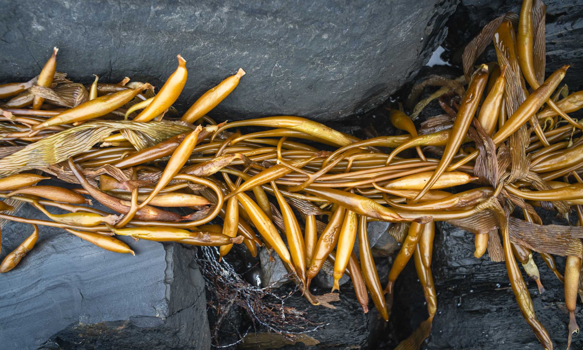
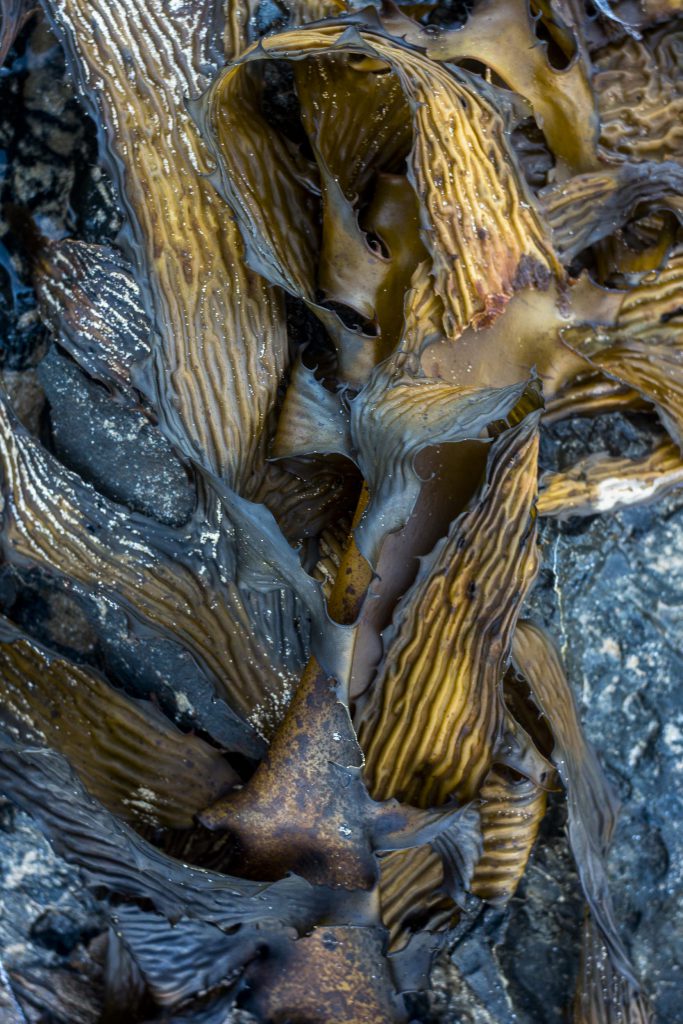
Winter on the southern Fleurieu Peninsula was wet and stormy with high tides on the coast, making it difficult to access the coastal rocks and to photograph along the littoral zone and continue making abstractions. During July walking the poodles was limited to walking along the paths on top of the coastal cliffs between Petrel Cove and Kings Beach.
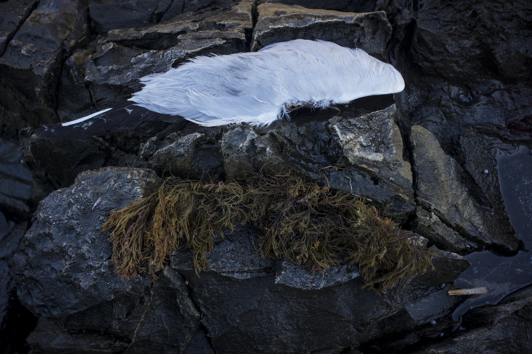
This image of seaweed lying on the rocks was made in early June when the tide was low enough to walk in the littoral zone in June. It was during July that we experienced the very high tides.
seaweed + rocks
The photo was made just after we’d returned from the camel trek from Blinman to Lake Frome. I recall it being a joy to walk by the sea after 14 days in the arid Northern Flinders Ranges. Water there was scarce: the creeks were dry and there was just the odd water hole.
It has been a very cool summer so far. The days have been overcast and windy with occasional rain. We have only had the occasional hot summer day. Maybe a more normal summer will come during the months of February and March.
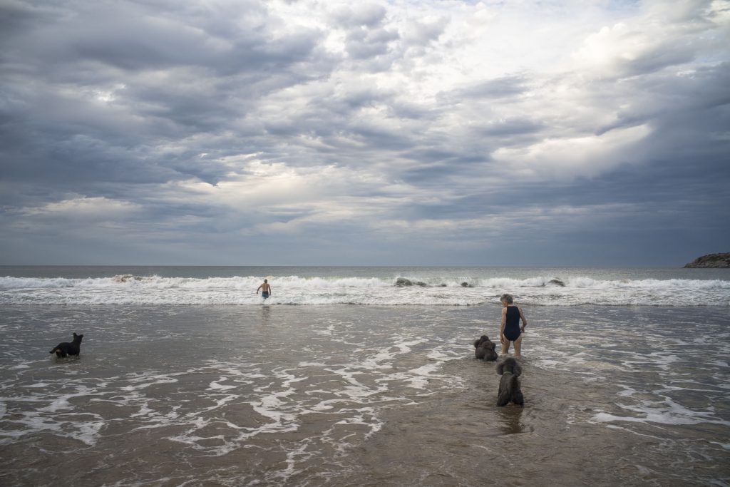
The picture below was snapped at 7am on a Sunday morning at Petrel Cove in January 24th). It is not a typical morning: it was humid, the temperature was in the high twenties, and there was no wind. It rained latter in the day.
at Petrel Cove
My energies in this last month have been renovating the Mallee Routes website, working on The Long Road to the North blog, and putting The Bowden Archives into some sort of order. My days have been spent sitting in front of a computer screen.