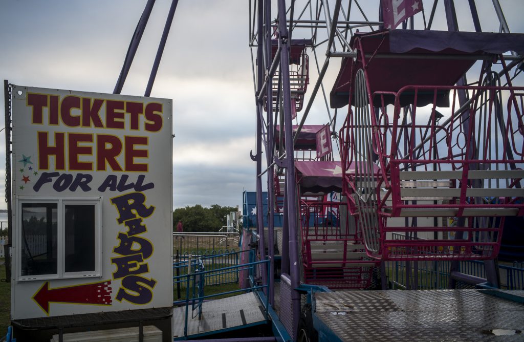
The summer holidays on the southern coast of the Fleurieu Peninsula, which are associated with childhood vacations and dreams, ended with the Australian Day long weekend. Suddenly the summer holiday crowds thinned–apart from the boaties hunting the blue fin tuna. The fun fair has packed up and gone until the school holidays,
funfair
The brief period of cooler days that we experienced has also gone with the return of the hot weather, with its temperatures around 40 degrees and northwesterly winds. These are conditions that generate the “fire flume,” as historian Stephen Pyne calls the hot northerly winds that sweep scorching air from inland Australia into the forested ranges of Victoria, South Australia and Tasmania. Australia was burning.
Hopefully, the fires still burning on Kangaroo Island, the Adelaide Hills and the Orroral Valley fire south of Canberra do not to flare up into mega-fires , which mean that the very question of the habitability of Australia now stares us in the face. Will these fires be a tipping point amongst the general public?
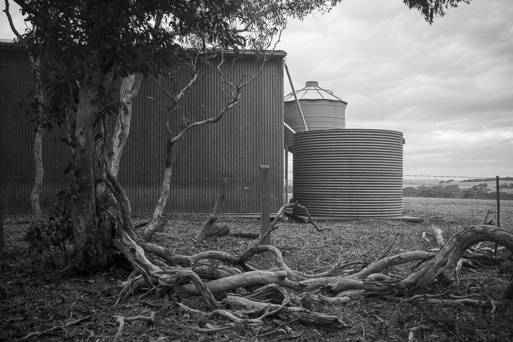
As mentioned in this post on my Encounter Studio blog I have started to explore the back country roads and the agricultural landscape in and around Waitpinga whilst on our afternoon poodlewalks. The Fleurieuscapes project needs to include the rural landscape in order to have some balance to the coastal images in the littoral zone. Most of the space of the Fleurieu Peninsula is an agricultural landscape consisting of dairy farms, grazing land for sheep and cattle, and the rapidly expanding vineyards.
I do struggle with photographing this subject matter, and most of what I see and then scope with a digital camera on our poodlewalks is boring and uninteresting, especially when I look at the digital files on the iMac’s computer screen. I am finding it to be a depressing and disheartening process.
One exception is this picture of pink gum, with a farm shed, silo and water tank along Pitkin Rd in Waitpinga that I came across on an exploratory afternoon poodlewalk with Kayla and Maleko:
Pitkin Rd, Waitpinga
This scoping picture was made in the autumn, when I first started to consciously explore the back country roads in Waitpinga. This picture of a dry, agricultural landscape works much better for me in black and white. The initial colour image looks too pretty and touristy–the photos would be what you would see in a feature in the glossy Fleurieu Living Magazine.
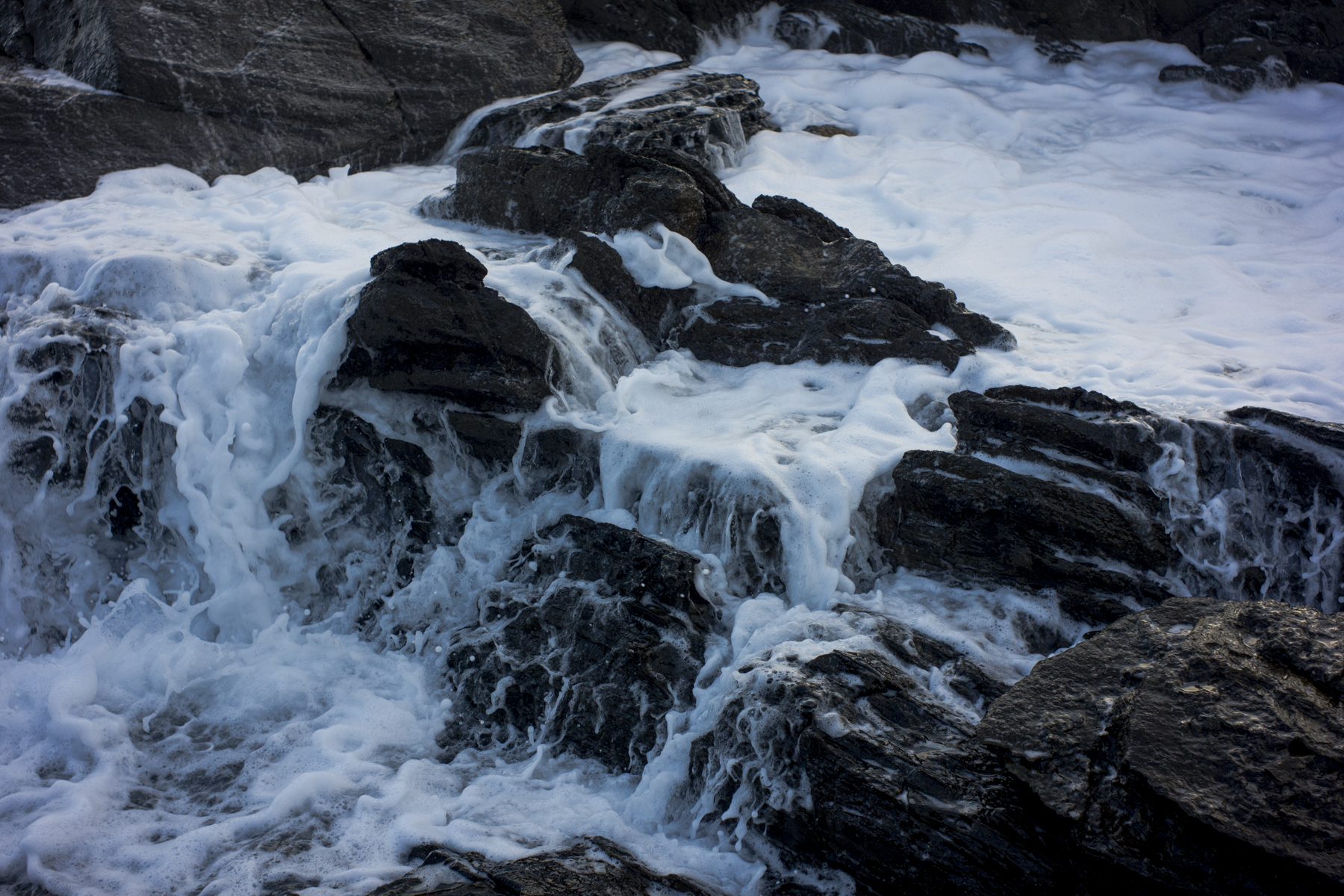
It has been a wild start to winter in South Australia. We have been experiencing a week of wet, stormy weather on the southern coast of the Fleurieu Peninsula. The coast has been battered by cold and blustery south westerly and southerly winds, rain and surging seas. The sand on the small, local beaches (Petrel Cove and Deps Beach) is starting to disappear.
The balmy days of late autumn with the early morning macro photography in the gentle early morning light are a memory. The two photos in this post were the last macro photos I made before the cold winter weather set in.
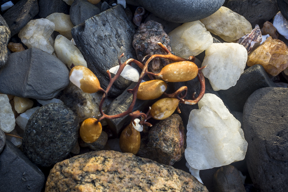
pebbles, Deps Beach
I have avoided walking along the littoral zone and have started walking along the back country roads seeking protection from the wind. That means photographing trees and back country roads. The weather is easing, but we still have sporadic showers and strong, cold winds.
As mentioned in an earlier post it is very quiet along the southern coast of the Fleurieu Peninsula these days, even after the rains. Despite the atmospheric conditions it’s only the locals who are out and about in the early morning before sunrise.
When I parked the Forester at the Petrel Cove carpark before dawn this morning (May 20th) it looked as if the ‘after the rains’ scenario was a misreading of the weather. The cloud cover was heavy, the clouds were dark, and there was rain out at sea. So I put a rain coat on, left the tripod and Rolleiflex SL66 in the boot of the Forester and went walking.
Kings Head, Waitpinga
As we walked along the Heritage Trail to Deps Beach and the rocks beyond the beach Kayla and I encountered an echinda making its way along the Trail. I saw a couple of seals and a pod of dolphins hunting in the sea along the edge of the coastal rocks. There was the odd speckled Pacific Gull sitting on the rocks and some seagulls. Apart from that we had the coast to ourselves as we made to the rocks past Deps Beach.
It has been cool weather with lots of rain. There has been very little in the way of the hot, dry summer days that we are used to, and that we have come to expect, on the coast. The damp conditions have meant that the wood panels and stairs that I had oiled before Xmas were very slow to dry. The oil fumes hung around for days.
ocean + rain
The rains have been due to a sub-tropical rain depression that hung over South Australia for several days between Xmas and New Year, destroying all the ripening stone fruit. The depression bought the small flies that clung to your body, and they were really unpleasant on the early morning poodlewalks.
We visited Goolwa Beach last Sunday afternoon. It was going somewhere different for us and the poodles, and a break from our normal walking routines. We entered the sand dunes near where the Goolwa Barrages go across the River Murray to keep out the incoming sea water, and it was only a short walk through the sandhills to the beach.
Suzanne + Ari
It’s an interesting region, but we’d forgotten that cars are allowed to drive along this beach to the mouth. The speed limit on the beach is 40 kilometres per hour. I have no idea why the Alexandrina Council allows this. How does that access to 10 kilometres along the Sir Richard Peninsula protect the unique and diverse coastline featuring open beaches, reefs and sand dunes, especially when people drive their vehicles on the sand dunes? The 4WD’s sure don’t “tread lightly”. Continue reading “Goolwa Beach”
I’ve been quietly scoping the landscape near the mouth of the Inman River during our early morning poodle walks along the Encounter Bay beach. I’m looking for traditional aboriginal sites to photograph as memorial sites. The pattern of British colonisation in South Australia deprived the Ngarrindjeri of access to their food and resources when they were removed from their lands and placed in missions such as Raukkan or fringe camps on the edges of towns like Meningie and Victor Harbor. Their historical presence as traditional owners is now marked by an absence in much of the landscape around Victor Harbor.
There is a cairn erected in Kent Reserve (i.e. on the western side of the Inman River) that commemorates one of the last camping grounds of the Ramindjeri tribe of aborigines, who were a local group or clan of the Ngarrindjeri nation, who lived around Lower Murray, Lake Albert and Lake Alexandrina and the Corrong. My understanding is the Ngarrindjeri form an Aboriginal nation of eighteen language groups who inhabit the extensive coastal Kurangk region that includes the Fleurieu Peninsula. Their lands and waters extended 30 kilometres up the River Murray from Lake Alexandrina, the length of the Corrong and along the coastal area to Encounter Bay. Their caring for country has seen them develop a Sea Country plan in 2006.
Ramindjeri land is the most westerly of the Ngarrindjeri, covering the area around Encounter Bay including Victor Harbor and Port Elliot. Kent Reserve was originally a traditional camping ground of the Ramindjeri people. Apparently, there is also an Aboriginal site described as an archaeological/burial site that is situated near the mouth of the Inman River, on the eastern side of the river. I’ve never seen it.
old Inman River channel
The river mouth of the Inman River was realigned by the Victor Harbor Council to protect the BeachFront Holiday Park in 1997. This picture is of a section of the old, meandering river channel behind the beach and east of the caravan park. What is left of the channel is infill and a swamp/wetland. We are looking west to the location of last known campsite of the Ramindjeri.
Whilst Suzanne has been away walking the Heysen Trail around the Kapunda and Burra area in South Australia this week, I’ve been minding the standard poodle, processing and uploading some of the images from my road trips early this year, and planning the Mallee Highway silo project for next winter. I’m very limited in where I can go walking at the moment because I have to stay in, and around, areas that are from the dam grass seeds. They are everywhere.
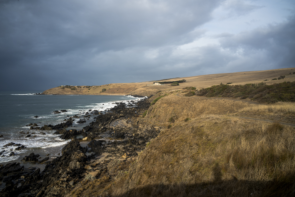
I have been limited to walking along the coastline at such places as Kings Beach and Kings Head where there are few people. Or walking along the country roads that are part of the Heysen Trail and that don’t have that many grass seeds amongst the roadside vegetation.
rockface, Kings Head
I cannot do much photography when I am walking with three dogs. I have to keep an eye on the dogs rather than use the poodle walks to look for photographic opportunities: Continue reading “struggling”
Spring means turbulent weather on the southern coast of the Fleurieu Peninsula rain, cold, sun, gusty wind, clouds. There can be 4 seasons in one day, or a couple of days of big storms followed hot weather where the day temperature changes by 10-15 degrees i.e., going from 15 degrees to 29, then back to 15 again.
The winter storms have stripped the beaches west of Rosetta Head of sand and it is not clear that the sand will return for the summer holiday season.
dead sea lion
The above carcass was washed up on what we call Dog Beach (it’s proper name is Debbs Beach, but unlike Kings Beach it doesn’t have its own Facebook page). I found it hard to identify what the carcass is. It’s definitely not a dolphin or a seal. My guess is that it is a sea lion.
Banks is on the eastern edge of this car-based, suburban city and is in the Tuggeranong district/valley. Banks is on the edge of Canberra’s outer suburban fringe. Our poodle walks in the morning and evening were along firebreak trails on both sides of the valley. We found the walks to be thoroughly enjoyable and attractive.
Banks, ACT
But you need a car to get around Canberra as the public transport to the city is woeful. It’s a long drive to school, work, shops, doctors, or leisure centres. Since the dominant mode of transport is by car, there is congestion in and around the CBD in spite of all the transport planning to ensure the flowing movement of the car.