meditative walking + photography

Sony A7111

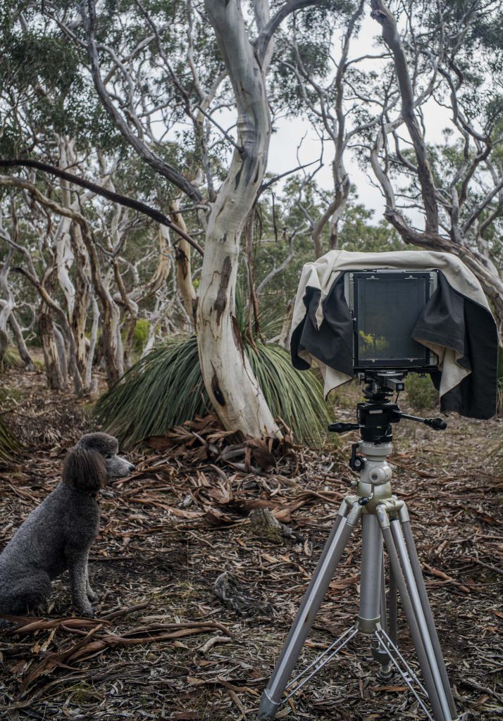
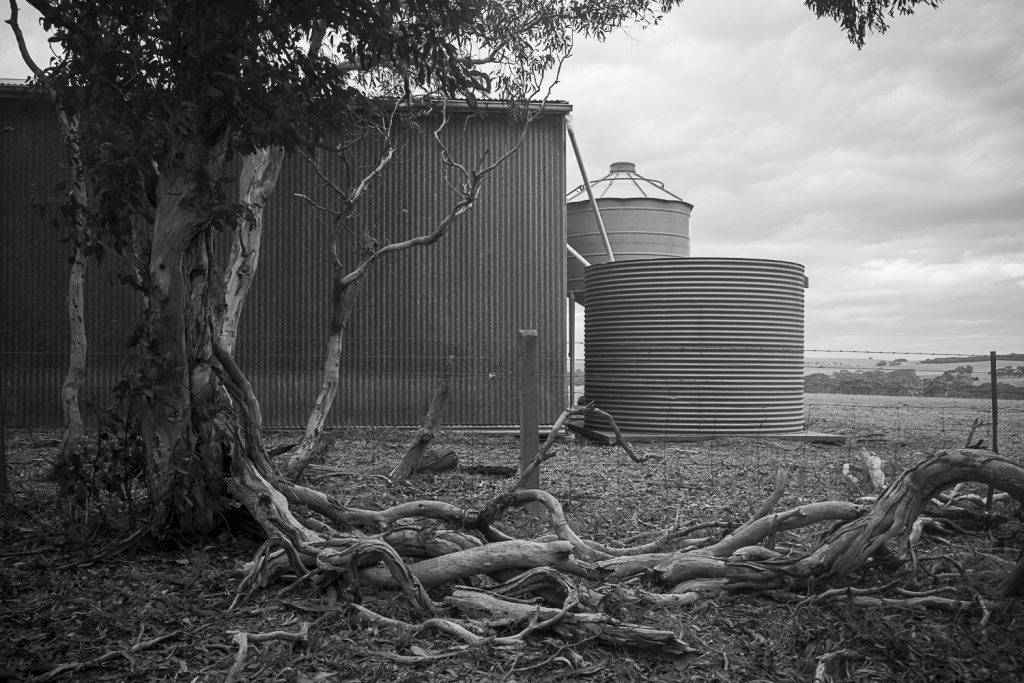
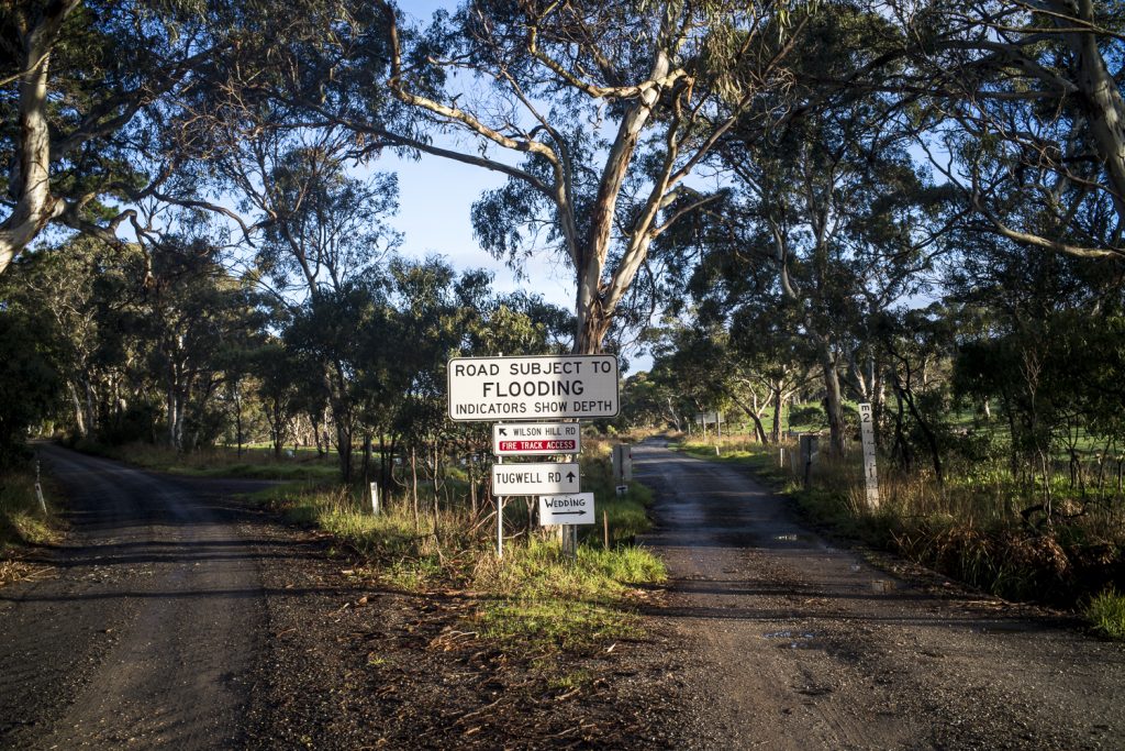
I mentioned in this Rhizomes post that my still photography that is made whilst walking with the standard poodles in the local bushland has been in the process of changing. It had been changing from photography as a way of objectifying and distancing us from the world towards an understanding that the practice of photography is similar to the practice of meditation. Similar in the sense of paying mindful attention to whatever is occurring in the moment.

This is akin to the immersive processes that Walter Benjamin and Theodore Adorno called mimesis — – a basic open comportment to the world. Adorno held that a mimetic capacity is spontaneous, pre-reflective, non-conceptual and rational and that it is the moment of the elective affinity between knower and known. We have become oblivious of our immersive mimetic capacity in modernity since in Western history, mimesis has been transformed by Enlightenment science from a dominant presence into a distorted, repressed, and hidden force. In modernity art is a refuge for mimetic comportment.

In this post I will begin to unpack mimesis and how art is mimetic of the world in terms of meditiative walking and seeing in relation to photography by relying on Ken Hughes-Parry’s RMIT thesis Towards Nothing: Photographing through the lens of Zen Intuition.

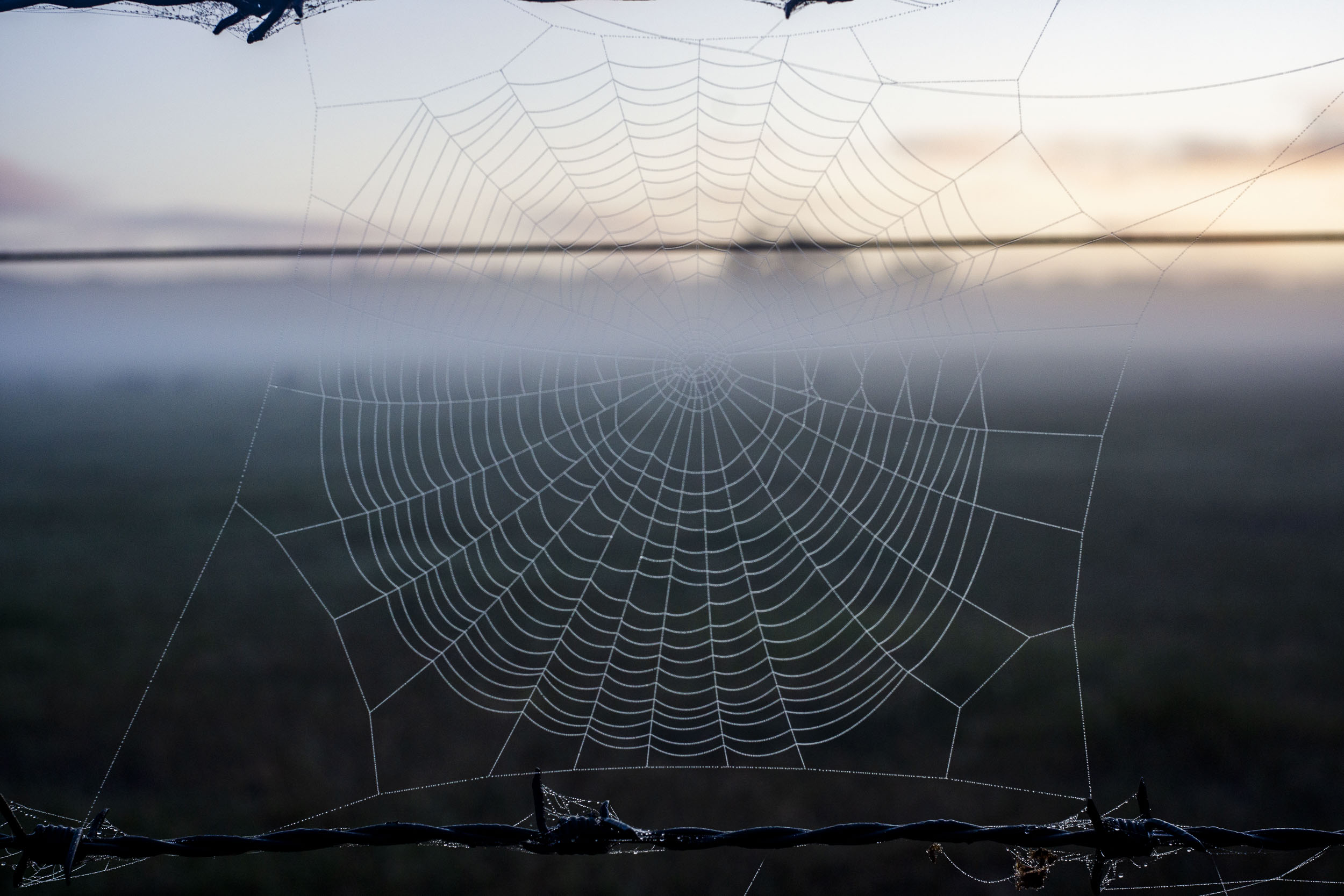
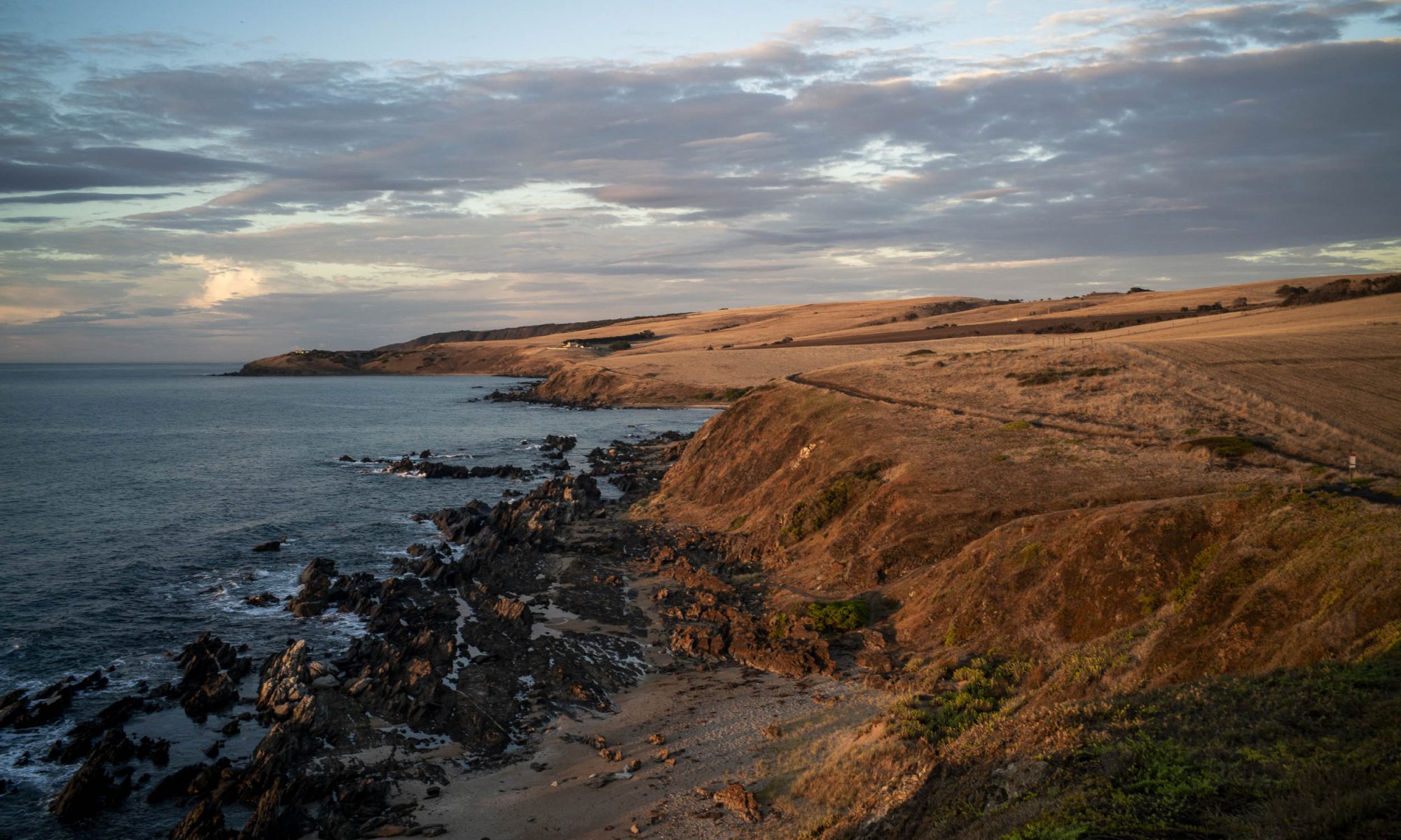
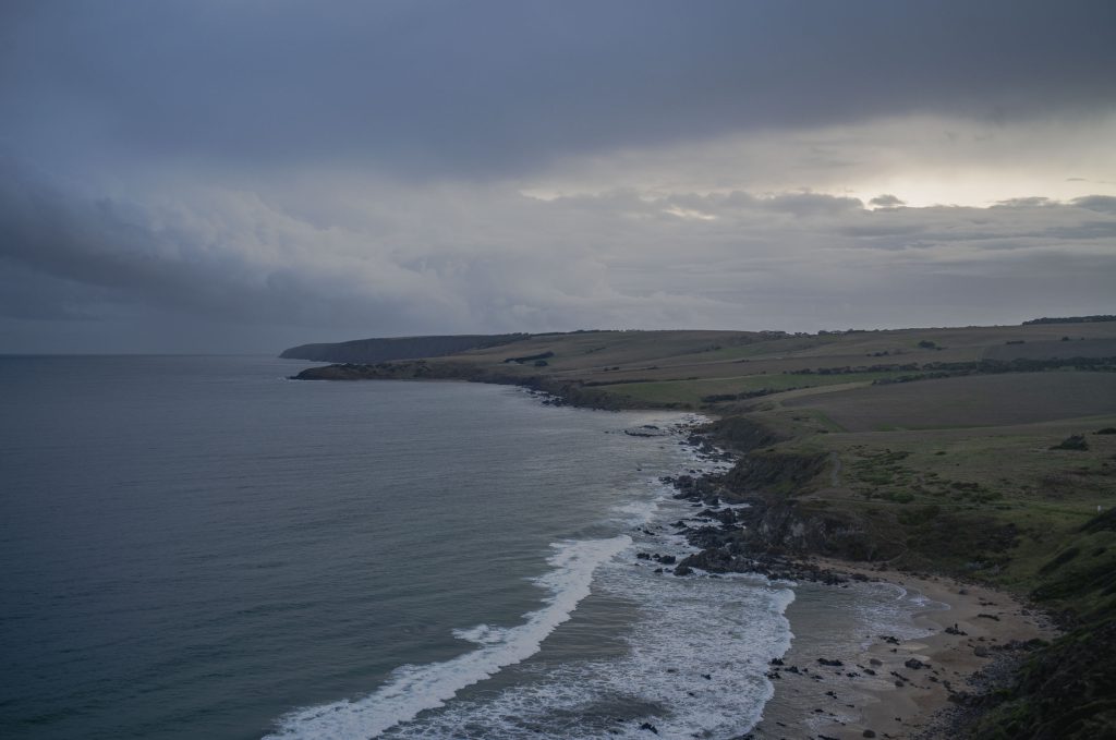
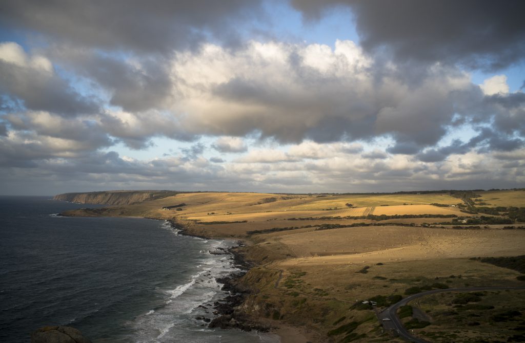
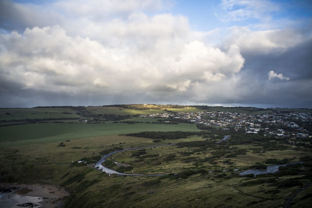
Initially mimesis as mediative seeing means that the automatic habitual view of the familiar world of an agricultural landscape that I am walking through in the early morning is replaced by being in a space with a keen sense of the unprecedented and unrepeatable configuration of each moment. In the photo below the particular moment of being in the world was a momentary one. The sun suddenly appeared in the background and the mist quickly evaporated.

This embodied clear seeing of a walking photography practice is less a form of contemplative state of mind and more of an empty one coupled to bodily awareness. It is a spontaneous intuitive seeing that is pre-conceptual. Embodied because the intuitive seeing is initially more felt and spontaneous than reflective ie., evaluating and judging the view around me for the sake of making a more considered composition.

Petrel Cove: Tourist development #2

The development pressure on the coastline around Rosetta Head continues and it takes the form of marinas, cruise ships and building tourist accommodation on agricultural land. As expected these forms of development give rise to political tension and conflict between economic development, heritage and environmental protection. These are currently managed within a single planning rule book  in which the policies reflect and align with the Government’s state planning policies that set out a framework for land use in South Australia.

Below is the text of the oral presentation that I gave to the Council Assessment Panel (CAP) of the Victor Harbor Council’s on Tuesday 9th May about the tourist development at Lot 2 Jagger Rd. The meeting’s agenda is here. Lot 2 is just west of Petrel Cove and it is the first paddock in the photo below. The other photos in this post are of the coastal rocks below Lot 2.

We were allowed 5 minutes to speak on the basis of our original written submissions and it was expected that new material would be presented, rather than just rehashing the written submission which had already been read by the expert panel members. I spoke to this text.

——-

Thankyou for providing me with a space to speak to the Tirroki development application in the context of the SA Planning and Design Code. This is the cornerstone of South Australia’s current planning system and it ‘s structure provides us with a way to judge developments within specific public criteria.

The Tirroki development consists of 5 well designed self-contained accommodation units, service building and associated infrastructure. Max Pritchard’s architecture is good tourist design and it will enhance the built environment at Encounter Bay, some of which is second rate and shoddily built.

I will make two points with respect to this tourist development in a rural zone with its 11 overlays.

an 8 x 10 poodlewalk

A recent afternoon poodlewalk in the local Waitpinga bushland in the southern Fleurieu Peninsula incorporated an 8×10 photo session. This session was a response to a disappointing one in the Spring Mount Conservation Park the previous day. Then I never even took the 8×10 out of the Forester. I had been hoping for misty conditions when I was driving there, only to encounter light rain when I was walking around.

Maleko + 8×10 Cambo, Waitpinga

It is more accurate to say that on the Waitpinga poodlewalk the photo session was first and the poodlewalk with Maleko came afterwards. I carried the camera equipment to the site, made the photo, returned the equipment to the Forester, then Maleko and I went on a walk through the bushland.

them’s the lucky breaks

My days during the first week of October have been spent in front of my old iMac computer struggling to get The Bowden Archives and Industrial Modemity into shape as a book project. The roots of the project are in an unfinished MA (in images and dissertation) at Flinders University in the 1980s. Unfinished because I’d put it and the photography to one side to do a PhD in philosophy.

The title of the proposed book has been recently changed in response to criticism that the original title The Bowden Archives and Other Marginalia was very misleading because it down played the non-Bowden sections.

I have been working on, and reworking, the No Longer, Not Yet text for the Roadtrips photo gallery, as this text has been causing me a lot of grief. I have only managed to produce a rough draft so far. Finally, this draft text does connect with the reset of the book, and at this stage, I am happy to count the small steps as big achievements. Giant steps in fact.

So there has been very little photography done over and above what was snapped whilst on the various poodlewalks:

Dep’s Beach, Waitpinga

Sometimes, on these walks, there were photo possibilities, other times there was nothing. It was pretty much hit and miss. Some days I don’t even bother taking the camera out of the car as I wanted to get the walk over quickly because I felt compelled to get back to the computer to keep working on the text. It’s like returning to being in PhD mode.

in training

An added dimension to the poodlewalks is that I am starting to train for the 14 day camel trek in late in May 2021 from Blinman to Lake Frome. This forthcoming camel trek is part of this project.

So I have started to walk to and over Rosetta Head, run up the steps twice at Petrel Cove, and increase the poodlewalks to 90 minutes. I’ve started doing the Rosetta Head route with Kayla on Sunday mornings when Suzanne is walking on her loop route. I really need to increase my cardio and to toughen up my feet.

look west from Rosetta Head

Building up my strength and cardio is going to be long and slow as, unlike Suzanne, I am currently not going to the gym. My exercise levels and muscle strength have dropped unfortunately. These need to be substantially increased.

Rosetta Head

On Sunday mornings Suzanne changes her walking route. Instead of walking to and over Rosetta Head, she and Maleko do a loop walk: from Solway Crescent to Kings Beach Rd, along the coastal path or Heritage Trail to Petrel Cove, then back to Solway Crescent.

If the weather is cloudy or overcast on Sunday morning I take a break from my early morning walk with Kayla in the local bushland, or along Esplanade Beach, to walk up and over Rosetta Head.

On these occasions I often use the Sunday morning walk to Rosetta Head to make cloud studies and seascapes, though this is scoping is in a very exploratory sense. Rosetta Head provides a good vantage point for this kind of photography, but the actual scene that l do photograph depends on the type of light as well as the clouds.

Waitpinga bushland

As part of building up some supplementary images as a background for the forthcoming online walking/photography exhibition at Encounters Gallery I have been photographing in a small patch of bushland in Waitpinga. I needed a contrast to the Littoral Zone images.

bushland, Depledge Rd, Waitpinga

The roadside vegetation that I see whilst walking the back country roads is limited in terms of photographic subject matter. So I have been wandering and exploring this bushland on both the early morning with Kayla and at the late afternoon poodlewalks with Maleko.

Petrel Cove

During the Xmas summer holidays the population along the coast of the southern Fleurieu Peninsula trebles. The coast becomes Adelaide’s summer playground.

The beach at Petrel Cove will be full of people and families relaxing and having fun during the day, and we will no longer have this space to ourselves.

seascape, Petrel Cove, Victor Harbor

It becomes a space for us to avoid whilst on our poodlewalks. Unless we are there around sunrise or just after. That is when it is deserted.

Agricultural landscapes

As mentioned in this post on my Encounter Studio blog I have started to explore the back country roads and the agricultural landscape in and around Waitpinga whilst on our afternoon poodlewalks. The Fleurieuscapes project needs to include the rural landscape in order to have some balance to the coastal images in the littoral zone. Most of the space of the Fleurieu Peninsula is an agricultural landscape consisting of dairy farms, grazing land for sheep and cattle, and the rapidly expanding vineyards.

I do struggle with photographing this subject matter, and most of what I see and then scope with a digital camera on our poodlewalks is boring and uninteresting, especially when I look at the digital files on the iMac’s computer screen. I am finding it to be a depressing and disheartening process.

One exception is this picture of pink gum, with a farm shed, silo and water tank along Pitkin Rd in Waitpinga that I came across on an exploratory afternoon poodlewalk with Kayla and Maleko:

Pitkin Rd, Waitpinga

This scoping picture was made in the autumn, when I first started to consciously explore the back country roads in Waitpinga. This picture of a dry, agricultural landscape works much better for me in black and white. The initial colour image looks too pretty and touristy–the photos would be what you would see in a feature in the glossy Fleurieu Living Magazine.

a cold snap

Temperatures have dropped with winters cold snap since I have returned to Encounter Bay from the brief Murray Mallee photo trip to Claypans and beyond. It is now quite chilly in the morning and in the early evening. Though the days are still, there is little warmth in the sun due to the cloud cover.

I have started to walk the back country roads through the various agricultural landscapes on the early morning poodlewalks with Kayla:

Tugwell + Wilson Hill Rds

Surprisingly, I am encountering people who are running and walking along these back roads before sunrise. They, like me, are out walking and running around 6.30 am, which is roughly an hour before sunrise.