After the residency finished at LARQ in Queenstown we travelled across to Tunbridge in the Midlands for the night with Barb and Mal. I had a little time in the late afternoon to briefly scope for a 5×4 afternoon picture of the salt lake.
saltlake, Tunbridge
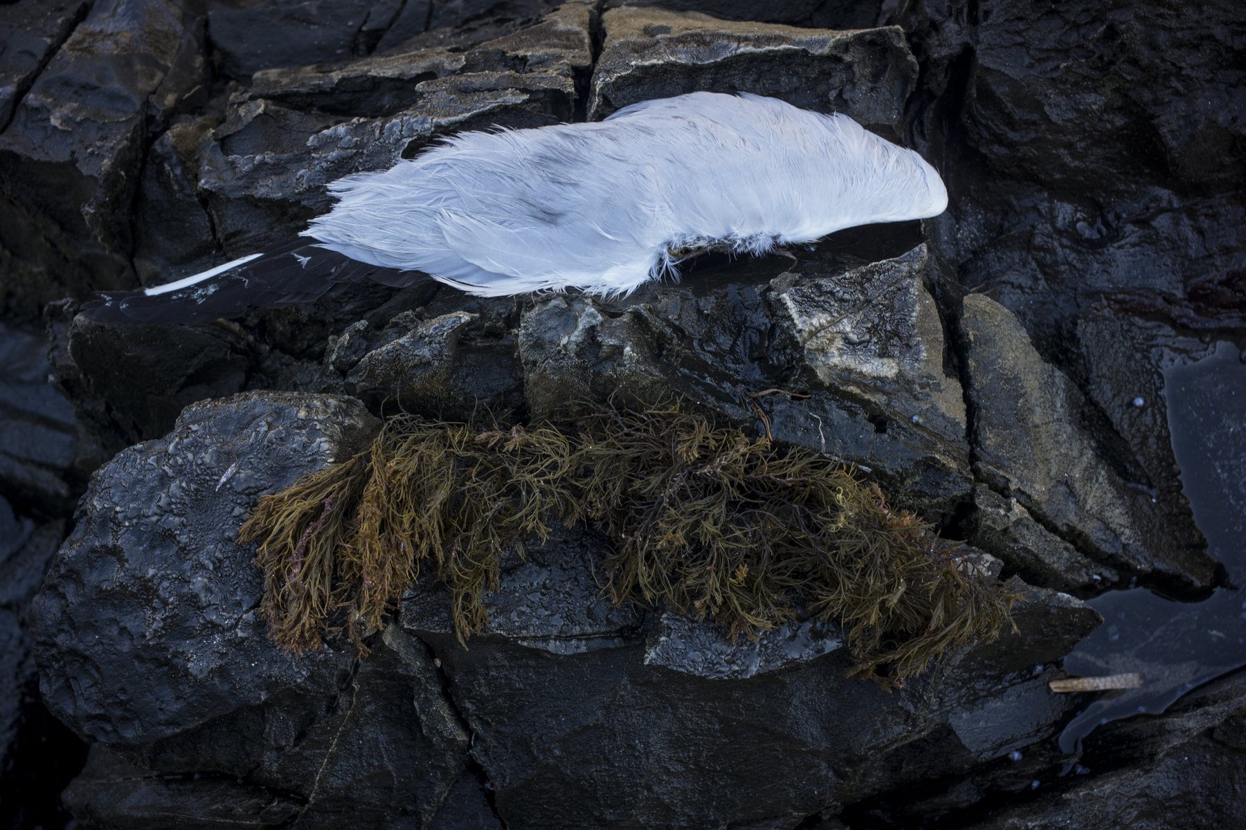
Then we travelled to Bruny Island for a couple of days holiday. Whilst the others did some bush walking in the South Bruny Island National Park I explored the sandstone cliffs at the edge of Adventure Bay.
The rains eventually eased in Queenstown and I was able to access the top of the open cut Lyell mine early Sunday morning. There were the usual showers and mist but these cleared and I was able to get some 5×4 pictures before the cloud cover disappeared.
Lyell open cut mine
I’ve decided to return to Queenstown in mid-May and take part in the Queenstown library’s re-photography project. It is the only way that I will be able to gain official access to photograph the open cut with the 5×4 Linhof as the mine is closed to the public apart from the 2 hour tour of the disused open cut mine.
The Queenstown Library has initiated a ‘then and now’ photographic project in relation to the 1912 Mt Lyell Mining disaster. It emphasizes both community involvement and re-photographing some of the photos of the open cut mine taken by the early twentieth century photographers.
Queenstown, Tasmania
I had a go at finding the sites used by Frank Hurley for his photographs of the Queenstown landscape and Mt Lyell mine out of interest. But I was way out. I just don’t know the area. Only a local with a keen topographical eye and a knowledge of the access roads could find the old sites now in order to show some continuity between the old and new images.
It was a foggy morning in Queenstown yesterday, so I wandered the town taking photos whilst Suzanne took the standard poodles for an early morning walk around the Queen River where it flowed beside near the Queenstown golf course. This was a space away from other dogs and they could be off the lead. So they could roam freely.
The early morning light in the town was soft, due to the fog:
Empire Hotel, Queenstown
I was looking/scoping for possible subjects for using the 5×4 Linhof in foggy conditions. What would the buildings or street views look like? How would they photograph? Would the fog transform the mundane into something interesting? Would the something interesting be meaningfully significant?
This is my second day in Queenstown, Tasmania. The first morning was very similar to what I’d encountered when I was here in April last year—very heavy fog in the valley until about 11am:
fog, Queenstown
The early morning walk with the standard poodles was in the fog until we climbed above it on soem kind of fire break or electricity track. When the fog lifted around 11am the rest of the day was bright, still and very hot. The night was quite mild.
I’m on the road for the next month —a phototrip to Tasmania. The trip is based around a 2 week residency at the Landscape Art Research Queenstown in Queenstown with a weeks holiday each side in the Midlands and Bruny Island.
Prada, Melbourne
This picture of the Prada shop window in Collins street is from an earlier trip to Melbourne before I turned towards topographics and began working on the documentary book.
The insurance company has come good with the money to replace my stolen digital Sony DSC R1. Soon I will have another digital camera, either a Sony Nex-7 or a Fuji X-Pro1. I have chosen these two cameras because they have adaptors that allow me to use my Leica M lenses with them. It’s a stop gap until I can afford a Leica M9. Whenever that is.
It is unlikely that either of the above digital cameras will arrive in Adelaide before I leave for a phototrip to Tasmania in early March. So I will be shooting film only on that trip. But I cannot wait to start using digital again. I miss the convenience of digital and I’m not really enthused with scanning negatives.
Hawke Building, Uni SA
This picture was taken on a photowalk one Sunday afternoon through the grounds of the University of South Australia’s City West campus. This is the southern or Fenn Place end of the Hawk Building.
This is one of the more interesting contemporary buildings in Adelaide. It was designed by John Wardle Architects (in association with Hassell Architects) and the southern end is an explosion of different forms that include sky bridges.
My exploratory wanderings in the CBD of Adelaide with a small digital camera are currently on hold, due to both the hot summer weather and not having replaced my stolen digital camera. This makes me uneasey in the sense of being disquiet—I should be walking the streets exploring, not stuck in front of a computer screen.
The picture below was snapped on a daily walk without the poodles at the beginning of summer in 2011:
Hyde St, Adelaide
I’m struck by how isolating the new apartments are. Each is contained within itself, so any contact or connecting with others comes digitally: with the mobile phone or email using mobile broadband. In this world of networked mobility people now walk the city streets looking at the pulsating screens of their smart phone, and they are only vaguely aware of what is around them. It appears that the virtual world is more important than the real world.
Adelaide, Wirranendi Park , film , Rolleiflex SL66
This is an earlier photo from the Wirranendi project. It is underexposed compared to this latter image. I’d forgotten to change the film speed on the light meter when I switched film backs on the Rolleiflex SL66. Silly me.
During the Xmas break at Victor Harbor I did some photographic studies of the road side vegetation on the back roads. These arose from searching for a place with some shade to walk the dogs away from the intense heat in the late afternoon. I just started looking at the shapes of the vegetation whilst walking down the dusty unsealed road. I was seeking new content–souping up my creativity or design juices.
roadside vegetation
The country side is basically all farmland—cattle and sheep– and what remained of the native vegetation was a strip along side the road. Even then a lot of that roadside vegetation had been cleared , and what remains is gradually degenerating.