
Kayla and I have started to walk along the various roads next to the various beaches in Encounter Bay so that I can photograph the seaside architecture. As these morning walks incorporate Hayborough, which is east of the Hindmarsh River, they can take several hours. The mornings have been overcast and the cloud cover has remained until 9am.
I have taken photos of the domestic seaside architecture before on previous beach walks, but not published any. I wanted to be a little more thorough. This house at 68 Franklin Parade is one that I have walked past many times, but I’ve never bothered to photograph it. It is quite secluded by the trees and bushes on the right hand side of the front of the property.
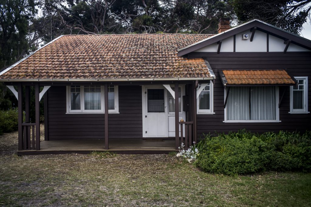
It stands out from the other beach houses on Franklin Parade because of the dark, brown wood, orange roof, and the trees. It is much darker and in deeper shadow than the other houses.