If it is autumn on the southern coast of the Fleurieu Peninsula, then it is still summer in Adelaide. So I discovered when I walked the city taking in the various Magic Object visual art exhibitions in this years Adelaide Festival of Arts whilst I waited for the Subaru Outback to be serviced.
I was more than happy to return to the cooler temperatures of the coast after spending several hours walking the city in the 36 degrees heat with its high humidity, due to a low-intensity heatwave that has hovered over south-eastern Australia for the past week. We have early autumn temperatures in the mid-to-high 20s on the coast.
On our return trip to Adelaide from Melbourne via the Great Ocean Road we tacked on a couple of days onto the return journey so that we could stay at Salt Creek in the Coorong. I wanted to go photographing, and to scope the area for the Edgelands project. This stopover was after we had spent a few days in exploring in the Otways.
Whilst at Salt Creek Ari and I walked in, and explored, the nearby edgelands on an overcast day for a future large format photoshoot:
Coorong
I had to admit it, but I got completely lost whilst wandering around scoping for some large format photography, and I had to rely on Ari to get me back to the car. I would have remained disorientated without Ari as I had just wandering around completely absorbed in photographing without giving much though to the fact that I was actually “bushwalking”, and that I hadn’t taken any precautions. Continue reading “walking in the Coorong”
When we stayed in some cottages for a couple of days near to Johanna Beach on our way back to Adelaide from Melbourne, Ari and I walked along the Old Ocean Road in the Otway Forest. This was a back country road with very little traffic, and so it was ideal for meandering along carrying a digital camera, the baby Linhof, Gitzo tripod, 6×9 film backs and light meter in the late afternoon.
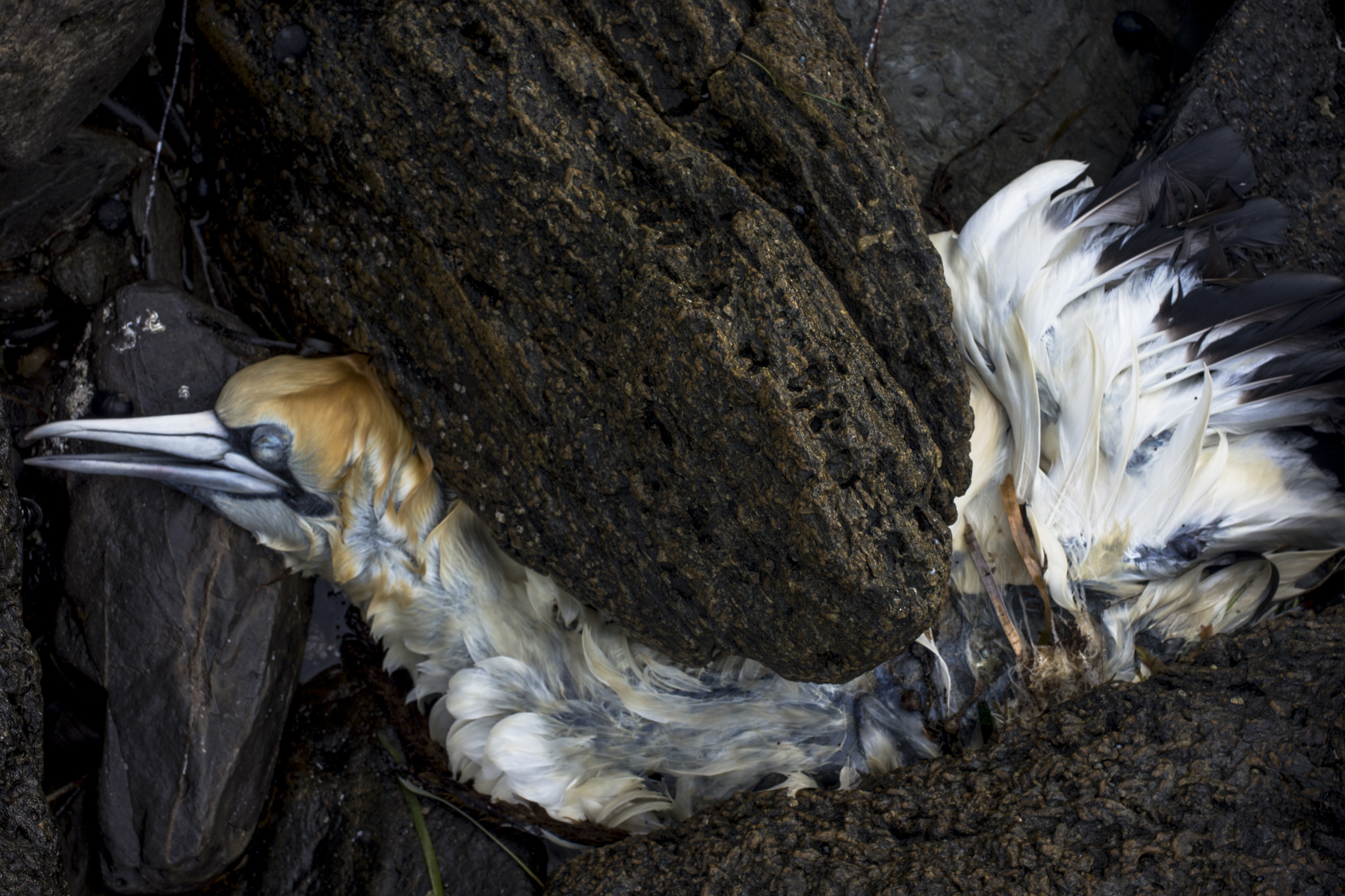
An example of me slowly finding my feet in the scrub/bush. Ari, Malek and I walked along the Heysen Trail in Waitpinga in the late afternoon and hung out at this spot:
Whilst Suzanne has been away walking the Heysen Trail around the Kapunda and Burra area in South Australia this week, I’ve been minding the standard poodle, processing and uploading some of the images from my road trips early this year, and planning the Mallee Highway silo project for next winter. I’m very limited in where I can go walking at the moment because I have to stay in, and around, areas that are from the dam grass seeds. They are everywhere.
I have been limited to walking along the coastline at such places as Kings Beach and Kings Head where there are few people. Or walking along the country roads that are part of the Heysen Trail and that don’t have that many grass seeds amongst the roadside vegetation.
rockface, Kings Head
I cannot do much photography when I am walking with three dogs. I have to keep an eye on the dogs rather than use the poodle walks to look for photographic opportunities: Continue reading “struggling”
My time recently has been spent working on the website’s various galleries Two of the earlier portfolios are now pretty much in place—Bowden and Port Adelaide. They look pretty good. The next step is to reconfigure the rest of the portfolios in this carousel style.
The daily poodle walks in both the morning and evening have been just quicker walks with little time being spent on scoping photography. The grasses are rapidly drying out on the coast and they represent a real problem as they hook onto the standard poodle’s coats, and then quickly work their way into the skin. So I am avoiding areas where there are lots of grass seeds.
Rambler, old dump, Victor Harbor
The Rambler picture in the old Victor Harbor dump was one of the last scoping photos that I’ve done. Rambler is slowly falling apart from neglect. Rambler was built by Peter Sharp at Cruickshanks Corner, Port Adelaide in 1875 and it was possibly Australia’s oldest racing yacht.
It used to on the slips at Searle’s Boatyard–in the historic boatyards in the Central Basin of the Port River–before Port Adelaide’s oldest surviving boatyard was closed down to make way for the residential waterfront redevelopment of Port Adelaide. The redevelopment at Newport Quays failed to regenerate Port Adelaide. The development of the expensive dog boxes on the waterfront was scrapped but not before it had successfully destroyed the fabric of the history of the port.
It is sad to see Rambler just being left in the ex-dump site to rot. It needed have been so, since it just wasn’t necessary to destroy the Port Adelaide’s oldest surviving boatyard for expensive dog boxes that never eventuated. Continue reading “a slow decay”
The weekend just passed was very springlike with warm temperatures, sunshine and blue skies. Suzanne wanted take us for a poodlewalk along Keen Rd last night, but we left it a bit late to start our and so we didn’t get all that far along the road. It runs over a hill between two valleys–Back Valley and Inman Valley. Unlike some of the country roads in the area Keen Rd has roadside vegetation.
Keen Rd is a section of the Heysen Trail in Waitpinga that she had walked with her group a month or so ago. Most of the Heyesen Trail in the Fleurieu Peninsula region is through conservation parks or farmland and these are off-limits for walking the poodles. We are basically left with country roads to walk along and when we do, we cross our fingers and hope that there there is little traffic in the late afternoon.
Keen Rd, Waitpinga
Unlike some of the country roads in the area Keen Rd has roadside vegetation. There was little car traffic last night apart from a truck carrying bales of hay from one paddock to the next. It left trails of dust that hung in the air for some time because the air was still— the coastal wind had died. Continue reading “walking Keen Road”
Winter has passed and spring has arrived in South Australia.
It is becoming warmer and the light is changing very quickly: sunrise is an hour earlier, sunset is an hour latter and the light is more intense and brighter early in the morning and in the late afternoon. The change in the seasons was very sudden.
Old Victor Harbor dump
The warmer weather means that there are more people on the coast, such as joggers, fishermen, dog walkers, walkers, surfies, day trippers, children swimming and playing on the beaches etc, which in turn makes our poodlewalks more complicated. People say that winter on the southern Fleurieu Peninsula coast is to be avoided, as they find it too cold.I enjoy the winter on the coast. Continue reading “Spring”
Whilst in Ballarat I stayed in a cottage in Creswick. Even though none of the poodles were with me on this phototrip, I did the equivalent of an early morning poodlewalk around the town. I initially wandered along a small creek behind the town centre where people were walking their dogs: