
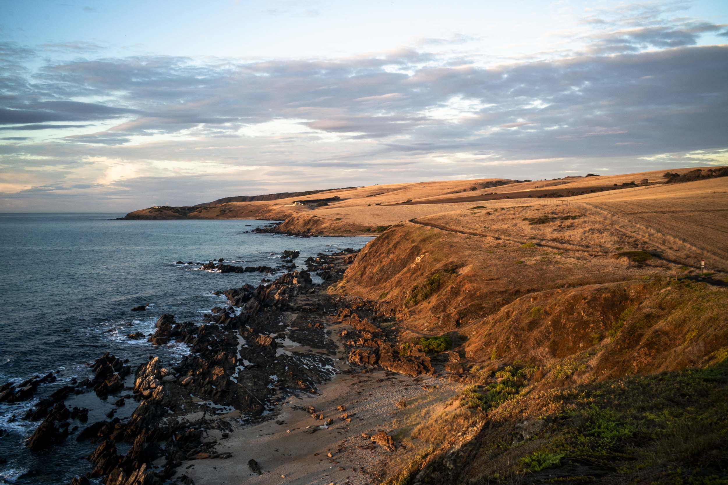
A map of the location of the proposed Rosetta tourist accommodation can be accessed here on the Plan SA website. The eastern edge of the proposed development is the first corner (just past Petrel Cove) in the picture below:
Though the architects are Max Pritchard Gunner (based in Glenelg, Adelaide) the design for the proposed tourist accommodation at Lot 2 Jagger Rd is not included in the list of their projects. It looks as if it is designed for high end tourism.
This is a significant tourist development of the coastline as currently there are just 3 farm houses between Petrel Cove and Kings Head, with Kings Beach Retreats situated on Kings Head in the background of the picture. Since the land use is zoned coastal open space it will not be rewilded. Farming will slowly give way to different land use.
So the questions are: what type of development is permitted for this type of zone in the development plan of Victor Harbor ? Is this proposed kind of high end tourist development an appropriate development for this coastal open space zone? How will the units be powered? Where is the water going to come from? What will happen to the wastewater? Will the farmland be greened? If so, how and to what extent will it help increase the biodiversity?
I cannot assess the proposed development in terms of its environmental impact, as I currently don’t know the answers to the above questions. Some research about the regional plan in the updated 30 year plan for the greater Adelaide planning region indicates that the above coastline area is defined as ‘complimentary developed landscapes’.
This mean “substantially modified farming landscapes where existing land uses and significant environmental values, different from those in Nature Protection Areas, co-exist in a way that provides mutual benefits. The generally open and undeveloped nature of these landscapes should be maintained through appropriate zoning to support continuation of the primary production systems that create environmental niches for target species.”
The next step is the regional development plan for Victor Harbor, which provides the recommendations for zoning and the framework for development, and requires an environmental impact statement for the proposed coastal development so as to evaluate consistency with the regional plan. The zone of the proposed development is coastal open space zone.
However, the cornerstone of the state’s planning reforms since 2020 is now the Planning and Design Code , which is outlined in this Introductory Blueprint. What is still unclear to me at this stage is who gives the planning consent (if any) to this development, and which is the most appropriate assessment pathway.
Developers have been targetting open spaces in urban areas too. Many of the first medium-density units were built on tiny blocks overlooking reserves, parks and ovals. In effect, monetizing public property.
Graeme,
In this in this case the developers are monetizing the Heritage Trail, the coastline and the sea. A new planning regime has just been put in place that is based zones and planning and design codes.
I’m looking for the enviromental impact study for this development.
One would like to think that these farms, when sold go some way to rewilding the area, in fact it should be compulsory considering the climate crisis we face. That however is probably too much to expect and developers, and councils will be rubbing their hands at the prospect of further development, and mostly for the more wealthy I imagine
Vikky,
well if the Kings Beach Retreats is anything to go by you are dead right. A new planning regime (statewide) has come into being since then so I presume the assessment of the development is out of the hands of the Victor Harbor council. The architecture will probably be better designed and it will be assessed without giving much consideration to the climate crisis. Definitely high end.