

First, I’ll draw an inference from the main point of my written submission.
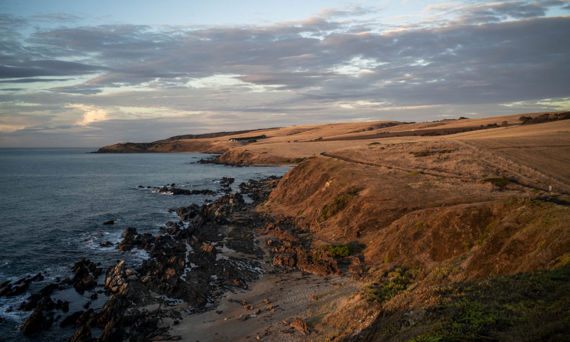
The proposed buildings are in a rural zone, which is an interface between urban areas (Encounter Bay) and primary production areas (farming). It is actually rural living as there are houses on the coastal farming properties along the Heritage Walking Trail with people living in them.
The planing and design issue here is to strike a balance between economic development (tourism) and primary production (sheep grazing or cropping). In this case the balance needs to be found within the context of an iconic and much loved coastal landscape.
My written submission held that this balance took the form of allowing economic development in the form of farm stay. It is quality tourism accommodation with a sizeable footprint. Farmstay it is not. To use the language of the Coast Protection Board this is scattered coastal tourist development without significant public or environmental benefit to the community.

It is dishonest for the category of farm stay to be used to push through high end tourism. This results in Farm stay becoming a trojan horse for tourism through questionable interpretations of the code around what is allowable in a rural zone. It would be much more honest to rezone the rural land so that high end tourism can be publicly assessed as to whether it is an appropriate form of coastal development in a region with significant scenic, iconic and heritage value. Then we could have a community debate about what type of development would be appropriate for this coastal area. But re-zoning is not on the agenda, nor is it being considered here.
Consequently, the issue is whether ad hoc tourist development in a rural zone without significant public or environmental benefit to the community is an appropriate form of coastal development in an area with significant scenic, iconic and heritage value. It is a crucial issue, given the context of the Victor Harbor Council’s long term Bluff Master Plan for Rosetta Head, which highlights the biodiversity asset value; the Heritage Trail and Wild Coast Way; and the cultural significance of Rosetta Head for the First Nation’s people.
The proposed ad hoc tourist development in a rural zone needs to be assessed in this context and the Ngarrindjeri people need to be consulted, given that Rosetta Head is a sacred site for them. The Council’s Master Plan acknowledges that the Bluff is “on the lands of the Ramindjeri and Ngarrindjeri people, the Traditional Custodians of the land and surrounding waters and it acknowledges their deep connection to Country and it pays our respects to Elders past, present and emerging.” Council cannot make this kind of statement and then ignore the concerns what the Ngarrindjeri people are saying, or not consult with them.

I saw no indication in the Tirroki application that this planning and cultural context was considered. Th application either operates in ignorance of, or it is part of what W.E.H Stanner called the Great Australian Silence in his 1968 Boyer Lectures. Significantly, the Coast Protection Board does not consider this context either — it only considers the impact of this ad hoc tourist development on the walkers on the Heysen Trail. It is a troubling omission.
Contrary to the recommendation of the planning staff of the Victor Harbor Council, my judgement is that this application as it stands be rejected.
———
My second point is premised on my understanding that this is a Performance Assessed Development application, and its focus is on the public notification requirements for Performance Assessed Development applications. The Planning, Development and Infrastructure Act 2016 states that the relevant authority will be responsible for giving notice of the application to all owners or occupiers of each piece of adjacent land in accordance with Section 107(3)(a)(i) of the Act. A notice or sign outlining the development must also be displayed on the land.

My understanding is that there is no exemption from the Minister to the required notification under the Planning and Design Code or Practice Direction. Consequently notification must be given to all the adjacent land owners by the relevant authority, A notice or sign outlining the development must also be displayed on the land.
(A) I never saw any such a sign. I either travel past Lot 2 Jagger Rd, or walk the Heritage Trail adjacent to the property, daily.
(B) My understanding is that only one adjacent land owner was informed by email, namely, the owner of 5 Minnamoora Court. Two properties (cnr of Rosemary and Jagger Rd) and number 9 Minnamoora Court were excluded, even though these are located respectively 48 and 52 metres from the Lot 2 entrance. The required distance is 60 metres.
So the relevant authority, which I take to be the Victor Harbor Council, has not fulfilled its legal responsibilities under the Act. The Act is quite clear on this. The relevant authority must undertake a process for public notification to all the adjacent land owners in relation to the proposed development. Notification must be properly given. It has not.
There is an exemption to this requirement. The exemption applies if the relevant authority is of the opinion that a proposed performance assessed development is a kind of development which is of a minor nature only, and will not unreasonably impact on the owners or occupiers of land in the locality of the site of the development. However, this exemption does not apply in this case, since the relevant authority informed the owner of 5 Minnamoora Court by email about the performance assessed development application.

So this means that the public consultation process undertaken needs to be repeated, this time with the relevant authority correctly fulfilling its responsibilities by applying the appropriate Planning and Design code and regulations under the Planning, Development and Infrastructure Act.
Thankyou for your time.